
1. Publication Draft North East Derbyshire Local Plan 2024 - 2044 (Reg 19)
Other elements in this consultation
5 Living Communities Comment
5.1 Introduction Comment
The Local Plan aims to ensure that a wide choice of good quality housing is provided in the District to meet the needs of all sections of the community. This chapter will identify housing allocations to support the levels of sustainable growth identified in the Spatial Strategy Chapter, policies which address the range of household needs, such as type and mix of housing, including affordable housing, specialist housingand agricultural, forestry and other occupational dwellings. It also addresses the needs of Gypsies, Travellers and Travelling Showpeople.
5.2 Housing Allocations Comment
Allocating a site in the Local Plan establishes the principle that the development of the site for housing is acceptable. Site allocations provide greater certainty both to developers and local people to help understand what may happen in their neighbourhood in the future. They also help the Council and infrastructure providers to look at the cumulative impact of development and plan for future needs, such as school places, transport improvements and water capacity.
The Local Plan should identify a sufficient supply and mix of sites, taking into account their availability, suitability and likely economic viability. Policy SS4: Spatial Strategy and the Distribution of Development in Chapter 4 sets out that the Local Plan will make provision for the delivery of a minimum of 11,260 dwellings over the period 2024-2044 (563 dwellings per annum), of which 10,757 are allocated in the Plan.
Sites which have been allocated in the Local Plan to provide the supply of sites to meet the housing land requirement are listed in policy LC1: Housing Allocations. The Housing Trajectory shows how these housing allocations are expected to be delivered during the plan period, including in the first five years.
Allocations have been made by balancing a range of considerations, such as the site’s availability, suitability and deliverability, and also the findings of the Sustainability Appraisal process. They include sites with or without planning permission.
Although historically small windfalls have made a positive contribution to housing delivery in the District[13], an allowance for future windfalls has not been factored into the calculation of housing supply. However, as explained in Chapter 4, they provide a flexibility allowance of approximately 75 dwellings per year to the housing supply.
The Plan will allocate only those housing sites which are capable of accommodating 5 or more dwellings. This threshold provides a good range of sites to be considered. Smaller sites can be allocated by Neighbourhood Plans, providing proposals conform to the relevant policies of the Local Plan.
The Council recognises that it is critical to monitor the delivery of allocated sites to ensure that sufficient housing is coming forward and that a five-year supply of deliverable sites continues to be available. In line with the NPPF, the Council should identify and update annually a supply of specific deliverable sites, sufficient to provide 5 years’ worth of housing against its housing requirement, with an additional buffer. This buffer may be set at 5% (moved forward from later in the plan period) to ensure choice and competition in the housing market, or 20% where there has been significant under-delivery over the previous three years, measured against the Housing Delivery Test.
From the start of the Plan Period, there has been no significant under delivery in relation to the Government’s Housing Delivery Test and therefore the housing trajectory includes a 5% buffer within the first five years after adoption. If in future monitoring years, the Housing Delivery Test indicates that there is significant under delivery over the previous three years (below 85% of the requirement) the buffer should be increased to 20% in the five-year housing land supply calculations. Where the Housing Delivery Test indicates that the delivery of housing was substantially below (less than 75% of) the housing requirement over the previous three years, or in situations where it is anticipated that the Council cannot demonstrate a rolling five-year housing land supply, a review of the Local Plan, in whole or in part, will be triggered.
Policy LC1: Housing Allocations Comment
The following sites are allocated on the Policies Map for housing to deliver the housing land requirement set out in Policy SS4: Spatial Strategy and the Distribution of Development:
|
Site |
Approximate Capacity within Plan Period* |
|---|---|
|
Level 1 Settlements: |
|
|
Strategic Sites |
|
|
SS5 – The Avenue |
545 |
|
SS6 – Former Biwaters |
178 |
|
SS7 – Duckmanton Moor |
1300 |
|
SS8 – Eckington South |
1450 |
|
Chesterfield |
|
|
CHE1 – Land West of Harehill Road, Chesterfield |
150 |
|
Clay Cross |
|
|
CC1 – Clay Cross South |
700 |
|
CC2 – Land adjacent to Kenning Park, Clay Cross |
50 |
|
CC3 – Land off Mill Lane, Clay Cross |
10 |
|
CC4 – Land West of Derby Road, Clay Cross |
45 |
|
CC5 – Land off Pilsley Road, Clay Cross |
10 |
|
CC6 – Land between High Street and Cross Street, Clay Cross |
15 |
|
Dronfield |
|
|
DR1 – Land North of Burns Drive and East of Southfield Mount, Dronfield |
235 |
|
DR2 – Land at Stubley Lane, Dronfield |
40 |
|
DR3 – Land adjacent to Meadow Grange Care Home, Holmesfield Road, Dronfield Woodhouse |
15 |
|
DR4 – Land North of Dronfield Woodhouse |
250 |
|
DR5 – Gladys Buxton Adult Education Centre, Oakhill Road, Dronfield |
27 |
|
Eckington |
|
|
ECK1 – EMH Care and Support Limited, Cherry Tree House, Cedar Close, Eckington |
30 |
|
ECK2 – Bradley Lomas Electrolok Ltd, Church Street, Eckington |
20 |
|
Killamarsh |
|
|
KIL1 – Land East of Upperthorpe Road, Killamarsh |
210 |
|
KIL2 – Land off Rotherham Road, Killamarsh |
160 |
|
KIL3 – Land off Primrose Lane, Killamarsh |
100 |
|
KIL4 – Land East of Barber’s Lane, Killamarsh |
70 |
|
KIL5 – Land South West of Upperthorpe Road, Killamarsh |
285 |
|
KIL6 – Land between Old Canal and North Side, Primrose Lane, Killamarsh |
42 |
|
Level 2 Settlements: |
|
|
Calow |
|
|
CAL1 – Land at Top Alley, Dark Lane, Calow |
35 |
|
CAL2 – Duckmanton Lodge, Chesterfield Road, Calow |
50 |
|
CAL3 – Land East of Dark Lane, Calow |
40 |
|
CAL4 – Land from East of Dark Lane to West of Oaks Farm Lane, Calow |
21 |
|
CAL5 – Land to the North and North West of The Homestead, Dark Lane, Calow |
35 |
|
Grassmoor |
|
|
GRA1 – Land South of Gill Lane, Grassmoor |
120 |
|
Holmewood |
|
|
HOLM1 – Land at Hunloke Road, Holmewood |
15 |
|
HOLM2 – Land South of 205 Chesterfield Road, Holmewood |
35 |
|
HOLM3 – Land East of Central Street, Holmewood |
60 |
|
HOLM4 – Holmewood Miners Welfare, Heath Road, Holmewood |
20 |
|
HOLM5 – Land off Tibshelf Road, Holmewood |
130 |
|
HOLM6 – Garage site at Shakespeare Crescent, Holmewood |
15 |
|
HOLM7 – Windy Ridge, Tibshelf Road, Holmewood |
136 |
|
Lower Pilsley (Pilsley Cluster) |
|
|
LPIL1 – Land at Tregarthyan House, Green Lane, Lower Pilsley |
240 |
|
LPIL2 – Land West of Parkhouse Road, Lower Pilsley |
75 |
|
LPIL3 – Land to the rear of Park House Farm, Lower Pilsley |
6 |
|
North Wingfield |
|
|
NW1 – Land North of Williamthorpe Road and East of Chesterfield Road, North Wingfield |
520 |
|
NW2 – Car Park at New Street, North Wingfield |
5 |
|
NW3 – Land South of 38 Chesterfield Road, North Wingfield |
64 |
|
Mickley (Shirland cluster) |
|
|
MIK1 – Land East of Mickley Infant School, Mickley |
150 |
|
Pilsley (Pilsley cluster) |
|
|
PIL1 – Land to the rear of Station Road, Pilsley |
90 |
|
PIL2 – Land to the rear of Manor House, Pilsley |
25 |
|
PIL3 – Commercial Inn, Bridge Street, Pilsley |
10 |
|
Renishaw |
|
|
REN1 – Land off Garden Avenue, Renishaw |
10 |
|
REN2 – Land at the Wynd, Renishaw |
50 |
|
REN3 – Land off Hague Lane, Renishaw |
400 |
|
Shirland (Shirland cluster) |
|
|
SH1 – Land North of Park Lane, Shirland |
45 |
|
SH2 – Land East of Park Close, Shirland |
80 |
|
SH3 – Land to the South of Hallfieldgate Lane, Shirland |
90 |
|
Stonebroom (Shirland cluster) |
|
|
ST1 – Land South of Carlyle Road, Stonebroom |
30 |
|
ST2 – Land South of Kingsley Crescent, Stonebroom |
420 |
|
ST3 – Land to the North of West Street and Quarry Lane, Stonebroom |
50 |
|
ST4 – Land off Pasture Lane, Stonebroom |
55 |
|
ST5 – Land to the rear of 14A-54 High Street, Stonebroom |
30 |
|
ST6 – Land to the North West of 101 Birkinstyle Lane, Shirland |
10 |
|
ST7 – The Bungalows, Stonebroom |
19 |
|
Tupton |
|
|
TUP1 – Land to side of 48 Nethermoor Road, Tupton |
10 |
|
TUP2 – Land East of Derby Road, Tupton |
160 |
|
TUP3 – Land West of Coupe Lane, Tupton |
250 |
|
TUP4 – Land at 26 Queen Victoria Road, Tupton |
80 |
|
TUP5 – South of Sunningdale Park and Birkin Park, Birkin Park, Tupton |
32 |
|
TUP6 – Land to the North and West of The Poplars, Ankerbold Road, Tupton |
219 |
|
Wingerworth |
|
|
WING1 – Belfit Hill Farm, Birkin Lane, Wingerworth |
20 |
|
WING2 – Land North of Spindle Drive and East of Deerlands Road, Wingerworth |
180 |
|
WING3 – Land at Rear of 263 Nethermoor Road, Wingerworth |
17 |
|
Level 3 Settlements: |
|
|
Ashover |
|
|
ASH1 – Land at the junction of Narrowleys Lane and Moor Road, Ashover |
26 |
|
ASH2 – Land South West of Grange Farm, Milken Lane, Ashover |
10 |
|
Heath |
|
|
HEA1 – Land at Ivy Farm, Heath |
10 |
|
HEA2 – Land to the South East of Main Road, Heath |
8 |
|
Long Duckmanton |
|
|
LDU1 – Former Coalite Site, Long Duckmanton |
270 |
|
Morton |
|
|
MOR1 – Land off Stretton Road, Morton |
160 |
|
Stretton |
|
|
STR1 – Prospect House, Highstairs Lane, Stretton |
15 |
|
Wessington |
|
|
WES1 – Land abutting Matlock Road, Wessington |
40 |
|
WES2 – Land at Proctor Cars, Matlock Road, Wessington |
115 |
|
Level 4 Settlements: |
|
|
Old Brampton |
|
|
BRAM1 – Land to the North of Hemming Green (East), Old Brampton |
6 |
|
BRAM2 – Land to the North of Hemming Green (West), Old Brampton |
6 |
|
TOTAL DWELLINGS |
10,757 |
Proposals that do not contribute to meeting identified local housing needs will not be supported.
Policy LC1 - CHE1: Land West of Harehill Road, Chesterfield Comment
Site Size: 5.02 ha
Indicative capacity: 150 dwellings
Site Specific Policy Requirements:
- The site has been released from the Green Belt. Development proposals must accord with the ‘Golden Rules’ set out in the National Planning Policy Framework.
- A design code must be produced for the development of the site, prior to the submission of a planning application, which must incorporate the requirements detailed below.
- Proposals must create development of the highest quality design and energy efficiency, with appropriate low carbon technologies following the principles in this Plan and the Successful Places Design Guide.
- The developable area of the site must exclude the Chesterfield Golf Club Local Wildlife Site extending into the western part of the allocation site.
- Development proposals must preserve the trees and woodland along the northern, eastern and southern boundaries of the site and their root protection areas. Any tree removal along the Harehill Road frontage must be limited only to that necessary to facilitate highway access, and development proposals must incorporate compensatory replacement planting.
- Development proposals must demonstrate how ecological enhancement will be incorporated alongside green and blue infrastructure throughout the site.
- The development must incorporate blue infrastructure and demonstrate how surface water flooding affecting parts of the site will be managed. These must include sustainable drainage systems which are effectively integrated into the layout of the development and measures which ensure flood risk is not increased elsewhere.
- The Public Right of Way crossing the southern part of the site must be retained, enhanced and incorporated into the design and layout of the development. Development proposals must also provide appropriate high quality pedestrian and cycle links to the wider Public Rights of Way and green infrastructure network.
- Development of the site must be informed by proportionate traffic surveys, junction capacity modelling and highway safety evidence, and any necessary mitigation in relation to highway safety and capacity will be secured at the planning application stage.
- The development must adequately mitigate any impacts associated with coal mining legacy and ground contamination.
- The following documents will need to be included with a planning application to address the issues specifically identified in this policy (alongside other validation requirements): Arboricultural Assessment and Landscape Plan, Landscape and Visual Impact Assessment, Ecological Assessment, Flood Risk Assessment and Drainage Strategy, Transport Assessment and Travel Plan (including Road Safety Audit), Coal Mining Risk Assessment, Ground Condition Investigation.
Policy LC1 – CC1: Clay Cross South Comment
Site Size: 29.02 ha
Indicative capacity: 700 dwellings
Site Specific Policy Requirements:
- A Masterplan Framework must be produced for the development of the entire site, prior to the submission of a planning application, which must incorporate the requirements detailed below, in order to ensure that all are achieved in a cohesive development. The Masterplan Framework must detail the phasing of the development to ensure that the infrastructure (i.e. non-residential) required by this policy is provided alongside the residential and other development within the allocation.
- Proposals must create development of the highest quality design and energy efficiency, with appropriate low carbon technologies following the principles in this Plan and the Successful Places Design Guide.
- The development must include a range of local facilities including a local centre comprising local retail and uses falling within use classes E (a-f)(subject to viability and marketing).
- Appropriate provision must be made for indoor and outdoor sport, recreation and open space needs arising from the development and contribute towards the enhancement of existing sport, recreation and green infrastructure facilities serving Clay Cross and the surrounding area, having regard to identified deficiencies in provision and the needs generated by the development.
- The development must provide high quality areas of public open space that are effectively integrated into the development through a landscape led approach to the location of development parcels.
- Landscape, visual and ecological impacts arising from the site's contribution to the rural setting south of Clay Cross, its visual prominence from the A61 and its role in maintaining physical and perceptual separation between Clay Cross and Stretton must be addressed by:
- retaining and reinforcing existing hedgerows, hedgerow trees and field boundaries, including the provision of green corridor landscape buffers along existing field hedgerows to incorporate strategic planting and improve pedestrian and cycle connectivity;
- retaining the western part of the site as a landscape buffer to protect the sensitive landscape edge, maintain physical and perceptual separation between Clay Cross and Stretton, and maximise views and visual connectivity with the wider landscape, including towards Stretton and St Bartholomew’s Church, and ensure that any access road through the buffer is designed and landscaped to minimise landscape and visual impacts; and
- ensuring that building heights do not exceed those of the existing settlement and that sensitive building orientation, structural landscaping and open space are incorporated adjacent to the western field and along the northern boundary and watercourse corridor to minimise visual impacts and integrate development into the landscape.
- Parts of the site fall within Flood Zones 2 and 3, in the north west and the centre of the site. Built development will not be permitted within these areas, which shall be incorporated into the site's green infrastructure, landscaping and drainage network, as a multifunctional corridor delivering flood management, biodiversity and recreation benefits.
- The development must incorporate blue infrastructure and demonstrate how surface water flooding affecting parts of the site will be managed. These must include sustainable drainage systems which are effectively integrated into the layout of the development and measures which ensure flood risk is not increased elsewhere and include measures that contribute to reducing flood risk in the wider area.
- Development must conserve, and where possible enhance, the significance of the Grade II listed milepost and its setting.
- Development proposals must conserve the archaeological significance of the Rykneld Street Roman Road along the A61.
- The Public Right of Way crossing the eastern part of the site must be retained, enhanced and incorporated into the design and layout of the development. Development proposals must also provide appropriate high quality and effective pedestrian and cycle links to Clay cross town centre, local services and facilities, and the wider Public Rights of Way and green infrastructure network, including green infrastructure corridors throughout the site and any necessary off-site improvements to facilitate active travel.
- Development of the site must be informed by proportionate traffic surveys, junction capacity modelling and highway safety evidence, and any necessary mitigation in relation to highway safety and capacity will be secured at the planning application stage. The development must provide mitigation measures associated with the trip generation impacts of the development to avoid a severe impact on the capacity of the highway network, including through investment in public transport infrastructure.
- Development of the site should preserve Best and Most Versatile Agricultural Landunless its loss is justified in accordance with national planning policy.
- The development must incorporate necessary mitigation measures in respect of ground contamination, noise, odour and air quality, and coal mining legacy.
- The following documents will need to be included with a planning application to address the issues specifically identified in this policy (alongside other validation requirements): Landscape and Visual Impact Assessment, Arboricultural Assessment and Landscape Plan, Ecological Assessment, Heritage Assessment, Archaeological Assessment, Flood Risk Assessment and Drainage Strategy (including detail of off-site enhancement measures), Transport Assessment and Travel Plan (including Road Safety Audit), Agricultural Land Classification Assessment, Coal Mining Risk Assessment, Ground Condition Investigation, Impact Assessment and mitigation strategies in relation to odour, noise and air quality, taking account of adjacent uses.
Policy LC1 - CC2: Land adjacent to Kenning Park, Clay Cross Comment
Site Size: 4.37 ha
Indicative capacity: 50 dwellings
Site Specific Policy Requirements:
- A design code must be produced for the development of the site, prior to the submission of a planning application, which must incorporate the requirements detailed below.
- Proposals must create development of the highest quality design and energy efficiency, with appropriate low carbon technologies following the principles in this Plan and the Successful Places Design Guide.
- Development proposals must conserve, and where possible enhance, the significance of Grade II listed St Bartholomew's Church, Clay Cross Conservation Area and their settings. Proposals must incorporate a heritage-led layout, design and siting, including appropriate mitigation measures such as substantial structural landscaping buffers.
- Landscape and visual impacts arising from the site’s relationship with the Church and High Street and its visibility from elevated viewpoints must be addressed by:
- retaining and reinforcing existing hedgerows, trees, including their root protection area, and existing scrub planting area as part of a comprehensive green infrastructure network and providing ecological enhancements;
- reducing the developable area to respond to the site's landscape sensitivities and secure an appropriate balance between built development, landscape buffers and open space;
- providing substantial green infrastructure, open space and structural landscaping within the western and northern parts of the site; and
- ensuring that reduced building heights, sensitive building orientation and appropriate landscaping are incorporated within the eastern part of the site.
- A watercourse crosses the western part of the site, with adjoining land falling within Flood Zones 2 and 3. Built development will not be permitted within these areas, which must be incorporated into the site's green infrastructure, landscaping and drainage network, as a multifunctional corridor delivering flood management, biodiversity and recreation benefits. Development proposals must also include measures that will materially reduce flood risk beyond the site’s boundaries.
- The Public Right of Way crossing the centre of the site diagonally must be retained, enhanced and incorporated into the design and layout of the development. Development proposals must also provide appropriate links to the Public Rights of Way network on the northern boundary and deliver high quality pedestrian and cycle connections to the urban green space on High Street in the east, taking account of rising topography.
- Development of the site must be informed by proportionate traffic surveys, junction capacity modelling and highway safety evidence, and any necessary mitigation in relation to highway safety and capacity will be secured at the planning application stage.
- A railway tunnel runs underneath the site. Development proposals must demonstrate that they will not negatively impact on the structural integrity, operation or safety of the railway tunnel or any associated infrastructure, including the tunnel shafts.
- The development must adequately mitigate any risks associated with coal mining legacy and ground contamination.
- The following documents will need to be included with a planning application to address the issues specifically identified in this policy (alongside other validation requirements): Heritage Assessment, Arboricultural Assessment, Landscape and Visual Impact Assessment, Flood Risk Assessment and Drainage Strategy (including detail of off-site enhancement measures), Transport Assessment and Travel Plan (including Road Safety Audit), Coal Mining Risk Assessment, Ground Condition Investigation, Ecological Assessment, Structural Integrity Assessment.
Policy LC1 – CC3: Land off Mill Lane, Clay Cross Comment
Site Size: 0.44 ha
Indicative capacity: 10 dwellings
Site Specific Policy Requirements:
- Proposals must create development of the highest quality design and energy efficiency, with appropriate low carbon technologies following the principles in this Plan and the Successful Places Design Guide.
- Development proposals must assess and, where present, protect species and habitat associated with Lowland Meadow. Appropriate buffers must also be provided alongside the adjacent watercourse and associated habitat corridor and ecological enhancement must be provided by development proposals.
- Development proposals must conserve, and where possible enhance, the significance of Grade II listed Clay Cross Tunnel South Portal and its setting.
- The proposal must include appropriate highway improvements and mitigation measures to ensure suitable access provision and visibility.
- Development proposals must adequately mitigate the impacts of noise associated with the adjacent railway line and risks associated with ground contamination and coal mining legacy.
- The following documents will need to be included with a planning application to address the issues specifically identified in this policy (alongside other validation requirements): Ecological Assessment, Heritage Assessment, Transport Statement, including Road Safety Audit, Noise Assessment, Coal Mining Risk Assessment, Ground Condition Investigation.
Policy LC1 – CC4: Land West of Derby Road, Clay Cross Comment
Site Size: 2.27 ha
Indicative capacity: 45 dwellings
Site Specific Policy Requirements:
- Proposals must create development of the highest quality design and energy efficiency, with appropriate low carbon technologies following the principles in this Plan and the Successful Places Design Guide.
- Development proposals should retain native hedgerows where possible and incorporate ecological enhancements.
- Development of the site must incorporate a heritage-led layout and design informed by the significance of Egstow Hall, its setting and the site’s historic association with it.
- Development proposals must conserve the archaeological significance of the Ryknield Street Roman Road along the A61.
- A public footpath, which crosses the site and is also identified as a proposed Key Cycle Network route, must be retained, upgraded and incorporated into the design and layout of the development, to ensure appropriate walking and cycle connections to the wider network. An appropriate pedestrian crossing to allow safe access to the pavement on the other side of Derby Road is also required.
- Development of the site must be informed by proportionate traffic surveys, junction capacity modelling and highway safety evidence, and any necessary mitigation in relation to highway safety and capacity will be secured at the planning application stage.
- The development must incorporate necessary mitigation measures in respect of ground contamination, noise, odour and air quality, and coal mining legacy.
- The following documents will need to be included with a planning application to address the issues specifically identified in this policy (alongside other validation requirements): Ecological Assessment, Heritage Assessment, Archaeological Assessment, Transport Statement, including Road Safety Audit, Coal Mining Risk Assessment, Ground Condition Investigation, Impact Assessment and mitigation strategies in relation to Odour, Noise and Air Quality, taking account of adjacent uses.
Policy LC1 – CC5: Land off Pilsley Road, Clay Cross Comment
Site Size: 0.19 ha
Indicative capacity: 10 dwellings
Site Specific Policy Requirements:
- Proposals must create development of the highest quality design and energy efficiency, with appropriate low carbon technologies following the principles in this Plan and the Successful Places Design Guide.
- Development proposals must provide a footway along the northern side of Pilsley Road to link to the existing footway, and a crossing point across Pilsley Road.
- The development must incorporate necessary mitigation measures in respect of ground contamination, noise, odour and air quality, and coal mining legacy.
- The following documents will need to be included with a planning application to address the issues specifically identified in this policy (alongside other validation requirements): Coal Mining Risk Assessment, Ground Condition Investigation, Impact Assessment and mitigation strategies in relation to Odour, Noise and Air Quality, taking account of adjacent uses.
Policy LC1 – CC6: Land between High Street and Cross Street, Clay Cross Comment
Site Size: 0.23 ha
Indicative capacity: 15 dwellings
Site Specific Policy Requirements:
- Proposals must create development of the highest quality design and energy efficiency, with appropriate low carbon technologies following the principles in this Plan and the Successful Places Design Guide.
- Development proposals must incorporate a heritage-led layout and design, informed by the significance of The George Public House (a Non-Designated Heritage Asset) and its setting, and any potential impact upon the setting of the Grade II listed St Bartholomew’s Church.
- Development proposals must conserve the archaeological significance of the Ryknield Street Roman Road along the A61.
- Development must deliver a well-designed scheme that responds positively to its gateway position, historic context and in part re-establishes the coherent block structure lost as a result of mid-20th-century road reprofiling and clearance.
- Development of the site must be informed by proportionate traffic surveys, junction capacity modelling and highway safety evidence, and any necessary mitigation in relation to highway safety and capacity will be secured at the planning application stage.
- The development must adequately mitigate any risks associated with coal mining legacy and ground contamination.
- The following documents will need to be included with a planning application to address the issues specifically identified in this policy (alongside other validation requirements): Heritage Assessment, Archaeological Assessment, Ground Condition Investigation, Coal Mining Risk Assessment.
Policy LC1 - DR1: Land North of Burns Drive and East of Southfield Mount, Dronfield Comment
Site Size: 11.86 ha
Indicative capacity: 235 dwellings
Site Specific Policy Requirements:
- The site has been released from the Green Belt. Development proposals must accord with the ‘Golden Rules’ set out in the National Planning Policy Framework.
- A design code must be produced for the development of the site, prior to the submission of a planning application, which must incorporate the requirements detailed below.
- Proposals must create development of the highest quality design and energy efficiency, with appropriate low carbon technologies following the principles in this Plan and the Successful Places Design Guide.
- Landscape, visual, ecological and heritage impacts arising from the site’s elevated position, relationship with the surrounding countryside, ecological features and the wider setting of Grade II listed Unstone Manor House and nearby potential Non-Designated Heritage Assets must be addressed by:
- retaining and reinforcing existing internal and boundary hedgerows and trees, including protection of root protection areas, as part of a comprehensive green infrastructure network;
- focusing built development upon the northern and western parts of the site to maintain openness, preserve the site’s sense of separation, minimise impacts on long distance views, and conserve, and where possible enhance, the significance of the setting of the heritage assets;
- retaining the existing field patterns to conserve the archaeological significance of the site;
- incorporating landscape buffers and green infrastructure to strengthen the transition to open countryside, soften the edges of development and minimise impacts on protected species.
- Development must be landscape led and ecological enhancements incorporated into the proposals.
- The Public Right of Way crossing the centre of the site must be retained, enhanced and incorporated into the design and layout of the development. Development proposals must also provide appropriate high quality pedestrian and cycle links to the wider Public Rights of Way and green infrastructure network.
- Development of the site must be informed by proportionate traffic surveys, junction capacity modelling and highway safety evidence, and any necessary mitigation in relation to highway safety and capacity will be secured at the planning application stage.
- Development proposals must incorporate necessary mitigation measures in respect of land contamination associated with the nearby former landfill site.
- Development proposals must incorporate appropriate measures to mitigate noise, odour and air quality impacts associated with the adjacent wastewater treatment works, industrial uses and railway, to achieve an acceptable living environment for future occupiers.
- The following documents will need to be included with a planning application to address the issues specifically identified in this policy (alongside other validation requirements): Landscape and Visual Impact Assessment, Arboricultural Assessment and Landscape Plan, Ecological Assessment, Heritage Assessment, Transport Assessment and Travel Plan (including Road Safety Audit), Ground Condition Investigation, Impact Assessment and mitigation strategies in relation to odour, noise and air quality, taking account of adjacent uses.
Policy LC1 – DR2: Land at Stubley Lane, Dronfield Comment
Site Size: 1.3 ha
Indicative capacity: 40 dwellings
Site Specific Policy Requirements:
- Proposals must create development of the highest quality design and energy efficiency, with appropriate low carbon technologies following the principles in this Plan and the Successful Places Design Guide.
- Development must preserve trees protected by Tree Preservation Orders both within and adjoining the site, including their root protection area. These trees must be integrated into the design and layout of the development.
- Development of the site must be informed by proportionate traffic surveys, junction capacity modelling and highway safety evidence, and any necessary mitigation in relation to highway safety and capacity will be secured at the planning application stage;
- Development of the site should preserve Best and Most Versatile Agricultural Landunless its loss is justified in accordance with national planning policy.
- The development must adequately mitigate any risks associated with coal mining legacy and contamination from former industrial/commercial uses on the land.
- The following documents will need to be included with a planning application to address the issues specifically identified in this policy (alongside other validation requirements): Arboricultural Assessment and Landscape Plan, Transport Statement, Ground Condition Investigation, Ecological Assessment, Coal Mining Risk Assessment, Agricultural Land Classification Assessment.
Policy LC1 – DR3: Land adjacent to Meadow Grange Care Home, Holmesfield Road, Dronfield Woodhouse Comment
Site Size: 0.7 ha
Indicative capacity: 15 dwellings
Site Specific Policy Requirements:
- The site must be developed for specialist housing for older or disabled people and include an element of support or care.
- The site has been released from the Green Belt. Development proposals must accord with the ‘Golden Rules’ set out in the National Planning Policy Framework.
- Proposals must create development of the highest quality design and energy efficiency, with appropriate low carbon technologies following the principles in this Plan and the Successful Places Design Guide.
- Landscape and visual impacts must be addressed by:
- Retaining and integrating existing boundary hedgerows and trees, including their root protection areas;
- Reinforcing the site’s boundaries through native planting and structural landscaping to strengthen containment; and
- Maintaining the vegetated boundary free from built development and incorporating a landscape buffer to mitigate views from the adjoining Public Right of way.
- Development proposals must conserve, and where possible enhance, the significance of the former Dronfield Woodhouse Board School (Meadow Grange Care Home) (a Non-Designated Heritage Asset) and its setting, Dronfield Conservation Area, and the wider setting of the Grade II* listed Dronfield Woodhouse Hall Farmhouse and outbuildings, and retain, where possible, the site's contribution to the open landscape character and rural setting of the former school.
- Development proposals must provide appropriate high quality pedestrian and cycle links to the Public Rights of Way network on the southern boundary.
- Development of the site should preserve Best and Most Versatile Agricultural Landunless its loss is justified in accordance with national planning policy.
- The following documents will need to be included with a planning application to address the issues specifically identified in this policy (alongside other validation requirements): Landscape and Visual Impact Assessment, Arboricultural Assessment and Landscape Plan, Heritage Assessment, Agricultural Land Classification Assessment.
Policy LC1 – DR4: Land North of Dronfield Woodhouse Comment
Site Size: 11.06 ha
Indicative capacity: 250 dwellings
Site Specific Policy Requirements:
- The site has been released from the Green Belt. Development proposals must accord with the ‘Golden Rules’ set out in the National Planning Policy Framework.
- A design code must be produced for the development of the site, prior to the submission of a planning application, which must incorporate the requirements detailed below.
- Proposals must create development of the highest quality design and energy efficiency, with appropriate low carbon technologies following the principles in this Plan and the Successful Places Design Guide.
- Development proposals must retain and protect native hedgerows, maintain ecological connectivity, provide appropriate mitigation and compensation measures to address impacts on skylark and other affected species and deliver on site ecological enhancements.
- Development proposals must conserve, and where possible enhance, the significance of the 18th-century outbuildings associated with Barnes Farm (including the archaeological significance of that site) and their setting, and the wider setting of the Grade II listed Upper Birchitt Farmhouse and Dronfield Woodhouse Conservation Area. Proposals must incorporate heritage-led design, layout and siting, including appropriate mitigation measures. These must include the retention of a landscape buffer to the south and south-west of Barnes Farm, a layout and scale of development that maintains the legibility of the farm outbuildings within their historic agricultural setting and development focused away from the western part of the site to minimise impacts on the setting of Dronfield Woodhouse Conservation Area.
- The development must incorporate blue infrastructure and demonstrate how surface water flooding affecting parts of the site will be managed. These must include sustainable drainage systems which are effectively integrated into the layout of the development and measures which ensure flood risk is not increased elsewhere and include measures that contribute to reducing flood risk in the wider area.
- The Public Rights of Way crossing the western and eastern parts of the site must be retained, enhanced and incorporated into the design and layout of the development. Development proposals must also provide appropriate high quality pedestrian and cycle links to the wider Public Rights of Way and green infrastructure network.
- Development of the site must be informed by proportionate traffic surveys, junction capacity modelling and highway safety evidence, and any necessary mitigation in relation to highway safety and capacity will be secured at the planning application stage.
- Development of the site should preserve Best and Most Versatile Agricultural Landunless its loss is justified in accordance with national planning policy.
- The development must adequately mitigate any risks associated with coal mining legacy and ground contamination.
- The following documents will need to be included with a planning application to address the issues specifically identified in this policy (alongside other validation requirements): Ecological Assessment, Heritage Assessment, Archaeological Assessment, Flood Risk Assessment and Drainage Strategy, Transport Assessment and Travel Plan, including Road Safety Audit, Agricultural Land Classification Assessment, Ground Condition Investigation, Coal Mining Risk Assessment.
Policy LC1 – DR5: Gladys Buxton Adult Education Centre, Oakhill Road, Dronfield Comment
Site Size: 1.23 ha
Indicative capacity: 27 dwellings
Site Specific Policy Requirements:
- The site has planning permission for 27 dwellings.
- If any new or revised planning application were to come forward during the Plan period, these must:
- provide either residential development or specialist accommodation for older or disabled people, including residential institutions within Use Class C2, where the proposal is compatible with the overall design, capacity and objectives of the allocation;
- create development of the highest quality design and energy efficiency, with appropriate low carbon technologies following the principles in this Plan and the Successful Places Design Guide;
- conserve, and where possible enhance, the significance of adjacent heritage assets and their settings through heritage-led design, layout and siting;
- retain and enhance existing recreational open space and facilities within the site. Where loss or redevelopment of recreational land or facilities is necessary, equivalent or improved replacement provision should be made in an appropriate location and be available prior to, or alongside, the development it serves; and
- adequately mitigate any risks associated with the site’s coal mining legacy and ground contamination.
Policy LC1 – ECK1: EMH Care and Support Limited, Cherry Tree House, Cedar Close, Eckington Comment
Site Size: 0.65 ha
Indicative capacity: 30 dwellings
Site Specific Policy Requirements:
- The site must be developed solely for affordable housing, with a minimum of one third of all dwellings provided as specialist accommodation for people with disabilities.
- Proposals must create development of the highest quality design and energy efficiency, with appropriate low carbon technologies following the principles in this Plan and the Successful Places Design Guide.
- The development must adequately mitigate any risks associated with ground contamination associated with former industrial and commercial uses.
- The following documents will need to be included with a planning application to address the issues specifically identified in this policy (alongside other validation requirements): Ground Condition Investigation.
Policy LC1 – ECK2: Bradley Lomas Electrolok Ltd, Church Street, Eckington Comment
Site Size: 1.28 ha
Indicative capacity: 20 dwellings
Site Specific Policy Requirements:
- The site has planning permission for 20 dwellings and is under construction.
- If any new or revised planning application were to come forward during the Plan period, these must:
- conserve, and where possible enhance, the significance of adjacent heritage assets and their settings through heritage-led design, layout and siting;
- demonstrate how ecological enhancement will be incorporated alongside green and blue infrastructure throughout the site;
- protect, retain and integrate the Tree Preservation Order trees and their associated Root Protection Areas into the design and layout of the development;
Policy LC1 – KIL1: Land East of Upperthorpe Road, Killamarsh Comment
Site Size: 10.62 ha
Indicative capacity: 210 dwellings
Site Specific Policy Requirements:
- The site has been released from the Green Belt. Development proposals must accord with the ‘Golden Rules’ set out in the National Planning Policy Framework.
- A design code must be produced for the development of the site, prior to the submission of a planning application, which must incorporate the requirements detailed below.
- Proposals must create development of the highest quality design and energy efficiency, with appropriate low carbon technologies following the principles in this Plan and the Successful Places Design Guide.
- Landscape, visual and ecological impacts arising from the site's elevated position, remnant medieval strip field pattern, ecological features and relationship with the open countryside must be addressed by:
- retaining, reinforcing and incorporating existing historic field boundaries, hedgerows and trees, including protection of root protection areas, within a comprehensive green infrastructure network, and preserving the site's historic field pattern;
- concentrating higher density development within the western parts of the site adjoining the existing settlement edge, while limiting development towards the eastern extent of the site to low densities; and
- incorporating landscape buffers and green infrastructure, including strategic planting along the northern and eastern boundaries and alongside Public Rights of Way, to soften views of development, strengthen the settlement edge. provide a sensitive transition to the surrounding countryside and provide ecological enhancements.
- Development proposals must conserve the archaeological significance of roman activity on Green Lane, to the Southwest of the site.
- The Public Rights of Way crossing the northern part of the site must be retained, enhanced and incorporated into the design and layout of the development. Development proposals must also provide appropriate high quality pedestrian and cycle links to the wider Public Rights of Way and green infrastructure network. Safe crossing points across Upperthorpe Road must be implemented to aid accessibility.
- Development of the site must be informed by proportionate traffic surveys, junction capacity modelling and highway safety evidence, and any necessary mitigation in relation to highway safety and capacity will be secured at the planning application stage.
- The development must adequately mitigate any risks associated with coal mining legacy and ground contamination.
- The following documents will need to be included with a planning application to address the issues specifically identified in this policy (alongside other validation requirements): Landscape and Visual Impact Assessment, Arboricultural Assessment and Landscape Plan, Ecological Assessment, Archaeological Assessment, Transport Assessment and Travel Plan (including Road Safety Audit), Ground Condition Investigation, Coal Mining Risk Assessment.
Policy LC1 – KIL2: Land off Rotherham Road, Killamarsh Comment
Site Size: 6.12 ha
Indicative capacity: 160 dwellings
Site Specific Policy Requirements:
- The site has been released from the Green Belt. Development proposals must accord with the ‘Golden Rules’ set out in the National Planning Policy Framework.
- A design code must be produced for the development of the site, prior to the submission of a planning application, which must incorporate the requirements detailed below.
- Proposals must create development of the highest quality design and energy efficiency, with appropriate low carbon technologies following the principles in this Plan and the Successful Places Design Guide.
- Development proposals must safeguard land required for the future restoration, operation and maintenance of the Chesterfield Canal, ensure that development does not prejudice its delivery, and contribute to the restoration and enhancement of the canal. The canal corridor must be incorporated into the design and layout of the development as a high-quality green and blue infrastructure corridor, providing structural landscaping, ecological enhancements and high-quality pedestrian and cycle connections, with buildings, streets and public spaces designed to provide a positive frontage and setting to the canal.
- Development proposals must conserve the archaeological significance of roman activity and the Chesterfield Canal.
- The development must incorporate blue infrastructure and demonstrate how surface water flooding affecting parts of the site will be managed. These must include sustainable drainage systems which are effectively integrated into the layout of the development and measures which ensure flood risk is not increased elsewhere.
- A watercourse and ponds cross the northern / north-eastern part of the site, with adjoining land falling within Flood Zones 2 and 3. Built development will not be permitted within these areas, which must be incorporated into the site's green infrastructure, landscaping and drainage network, as a multifunctional corridor delivering flood management, biodiversity and recreation benefits.
- Development proposals must demonstrate how ecological enhancement will be incorporated alongside green and blue infrastructure throughout the site, and retain trees including their root protection areas.
- Development of the site must be informed by proportionate traffic surveys, junction capacity modelling and highway safety evidence, and any necessary mitigation in relation to highway safety and capacity will be secured at the planning application stage.
- Development of the site should preserve Best and Most Versatile Agricultural Land unless its loss is justified in accordance with national planning policy.
- The development must incorporate necessary mitigation measures in respect of ground contamination, noise, and air quality, and coal mining legacy.
- The following documents will need to be included with a planning application to address the issues specifically identified in this policy (alongside other validation requirements): Archaeological Assessment, Arboricultural Assessment and Landscape Plan, Flood Risk Assessment and Drainage Strategy, Ecological Assessment, Transport Assessment and Travel Plan (including Road Safety Audit), Agricultural Land Classification Assessment, Ground Condition Investigation, Coal Mining Risk Assessment, Impact Assessment and mitigation strategies in relation to noise and air quality, taking account of adjacent uses.
Policy LC1 – KIL3: Land off Primrose Lane, Killamarsh Comment
Site Size: 4.37 ha
Indicative capacity: 100 dwellings
Site Specific Policy Requirements:
- The site must include specialist housing for older or disabled people in addition to the indicative capacity of 100 dwellings. The specialist housing must include a level of care, such as extra care housing or a care/nursing home.
- A design code must be produced for the development of the site, prior to the submission of a planning application, which must incorporate the requirements detailed below.
- Proposals must create development of the highest quality design and energy efficiency, with appropriate low carbon technologies following the principles in this Plan and the Successful Places Design Guide.
- Development proposals must safeguard land required for the future restoration, operation and maintenance of the Chesterfield Canal, ensure that development does not prejudice its delivery, and contribute to the restoration and enhancement of the canal. The canal corridor must be incorporated into the design and layout of the development as a defining feature of a high-quality green and blue infrastructure network by:
- providing structural landscaping, ecological enhancements and a substantial buffer to the Chesterfield Canal / Norwood Local Wildlife Site;
- retaining and protecting native hedgerows, trees, including their root protection area, and wetland habitats associated with the canal corridor, maintaining ecological connectivity and minimising impacts on species;
- providing high quality pedestrian and cycle routes with links to the wider Public Rights of Way and green infrastructure network;
- preserving the archaeological significance of the canal; and
- providing appropriate separation from adjacent industrial uses and the Health and Safety Executive consultation zone.
- The development must incorporate blue infrastructure and demonstrate how surface water flooding affecting parts of the site will be managed. These must include sustainable drainage systems which are effectively integrated into the layout of the development and measures which ensure flood risk is not increased elsewhere.
- Built development will not be permitted within land falling within Flood Zones 2 and 3 in the east of the site. These areas must be incorporated into the site's green infrastructure, landscaping and drainage network, as a multifunctional corridor delivering flood management, biodiversity and recreation benefits.
- Development of the site must be informed by proportionate traffic surveys, junction capacity modelling and highway safety evidence, and any necessary mitigation in relation to highway safety and capacity will be secured at the planning application stage.
- Development of the site should preserve Best and Most Versatile Agricultural Land unless its loss is justified in accordance with national planning policy.
- The development must incorporate necessary mitigation measures in respect of ground contamination, noise, odour and air quality, and coal mining legacy.
- The following documents will need to be included with a planning application to address the issues specifically identified in this policy (alongside other validation requirements): Archaeological Assessment, Arboricultural Assessment and Landscape Plan, Ecological Assessment, Flood Risk Assessment and Drainage Strategy, Transport Assessment and Travel Plan (including Road Safety Audit), Agricultural Land Classification Assessment, Ground Condition Investigation, Coal Mining Risk Assessment, Impact Assessment and mitigation strategies in relation to odour, noise and air quality, taking account of adjacent uses.
Policy LC1 – KIL4: Land East of Barber’s Lane, Killamarsh Comment
Site Size: 2.13 ha
Indicative capacity: 70 dwellings
Site Specific Policy Requirements:
- The site has been released from the Green Belt. Development proposals must accord with the ‘Golden Rules’ set out in the National Planning Policy Framework.
- A design code must be produced for the development of the site, prior to the submission of a planning application, which must incorporate the requirements detailed below.
- Proposals must create development of the highest quality design and energy efficiency, with appropriate low carbon technologies following the principles in this Plan and the Successful Places Design Guide.
- Development proposals must safeguard land required for the future restoration, operation and maintenance of the Chesterfield Canal and ensure that development does not prejudice the delivery of engineering works required to accommodate the canal's ascent between Nethermoor Lake and Primrose Lane. The design and layout of the development must facilitate future canal-related development and infrastructure and incorporate the canal corridor as a defining feature and focal point of the development. Buildings, streets and public spaces must be orientated towards the canal corridor and provide a positive frontage and setting, together with structural landscaping, ecological enhancements and high-quality pedestrian and cycle connections.
- Development proposals must conserve the archaeological significance of the Chesterfield Canal.
- Built development will not be permitted within land falling within Flood Zone 2 in the north of the site. This area must be incorporated into the site's green infrastructure, landscaping and drainage network, as a multifunctional corridor delivering flood management, biodiversity and recreation benefits.
- Development proposals must provide appropriate high quality pedestrian and cycle links to the wider Public Rights of Way and green infrastructure network to the east and west of the site.
- Development of the site must be informed by proportionate traffic surveys, junction capacity modelling and highway safety evidence, and any necessary mitigation in relation to highway safety and capacity will be secured at the planning application stage.
- Development of the site should preserve Best and Most Versatile Agricultural Land unless its loss is justified in accordance with national planning policy.
- The development must adequately mitigate any risks associated with coal mining legacy and ground contamination.
- The following documents will need to be included with a planning application to address the issues specifically identified in this policy (alongside other validation requirements): Archaeological Assessment, Flood Risk Assessment and Drainage Strategy, Transport Assessment and Travel Plan (including Road Safety Audit), Agricultural Land Classification Assessment, Ground Condition Investigation, Coal Mining Risk Assessment.
Policy LC1 – KIL5: Land South West of Upperthorpe Road, Killamarsh Comment
Site Size: 15.22 ha
Indicative capacity: 285 dwellings (remaining)
Site Specific Policy Requirements:
- The site has planning permission for 315 dwellings and is under construction.
- If any new or revised planning application were to come forward during the Plan period, these must:
- demonstrate how ecological enhancement will be incorporated alongside green and blue infrastructure throughout the site;
- retain and incorporate the Public Right of Way crossing the site into the design and layout of the development. Where practicable, it should be enhanced and connected to the wider green infrastructure network;
- conserve, and where possible enhance, the significance of adjacent heritage assets and their settings through heritage-led design, layout and siting;
- adequately mitigate any risks associated with the site’s coal mining legacy and ground contamination.
Policy LC1 – KIL6: Land between Old Canal and North Side, Primrose Lane, Killamarsh Comment
Site Size: 2.19 ha
Indicative capacity: 42 dwellings (remaining)
Site Specific Policy Requirements:
- The site has planning permission for 50 dwellings and is under construction.
- If any new or revised planning application were to come forward during the Plan period, these must:
- safeguard land required for the future restoration, operation and maintenance of the Chesterfield Canal, ensure that development does not prejudice its delivery, and contribute to the restoration and enhancement of the canal. The canal corridor must be incorporated into the design and layout of the development as a high-quality green and blue infrastructure corridor, providing structural landscaping, ecological enhancements and high-quality pedestrian and cycle connections, with buildings, streets and public spaces designed to provide a positive frontage and setting to the canal;
- demonstrate how ecological enhancement will be incorporated alongside green and blue infrastructure throughout the site;
- be supported by appropriate assessment of landfill gas, contamination and any other impacts arising from the adjacent landfill operation. Any necessary mitigation and remediation measures should be implemented to ensure the site is suitable for residential use.
Level 2:
Policy LC1 – CAL1: Land at Top Alley, Dark Lane, Calow Comment
Site Size: 1.15ha
Indicative capacity: 35 dwellings
Site Specific Policy Requirements:
- A design code must be produced for the development of the site, prior to the submission of a planning application, which must incorporate the requirements detailed below.
- Proposals must create development of the highest quality design and energy efficiency, with appropriate low carbon technologies following the principles in this Plan and the Successful Places Design Guide.
- Landscape, visual and ecological impacts must be addressed by:
- retaining, protecting and reinforcing existing hedgerows, trees and woodland, including their root protection areas, as part of a comprehensive green infrastructure network, and incorporating appropriate setbacks, tree planting and landscaping along the north-western boundary and Dark Lane frontage;
- focusing built development within the northern part of the site and retaining the southern part as open space and biodiversity habitat; and
- incorporating a layout that reflects the historic linear pattern along Dark Lane and reducing building heights to limit projection of roofs above existing canopies.
- Development proposals must provide appropriate high quality pedestrian and cycle links to the Public Rights of Way on the western boundary and wider green infrastructure network.
- Development of the site must be informed by proportionate traffic surveys, junction capacity modelling and highway safety evidence, and any necessary mitigation in relation to highway safety and capacity will be secured at the planning application stage.
- Development of the site should preserve Best and Most Versatile Agricultural Land unless its loss is justified in accordance with national planning policy.
- The development must incorporate measures to adequately mitigate any impacts associated with ground contamination and odour.
- The following documents will need to be included with a planning application to address the issues specifically identified in this policy (alongside other validation requirements): Arboricultural Assessment and Landscape Plan, Landscape and Visual Impact Assessment, Ecological Assessment, Transport Assessment and Travel Plan (including Road Safety Audit), Agricultural Land Classification Assessment, Ground Condition Investigation, Impact Assessment and mitigation strategies in relation to odour, taking account of adjacent uses.
Policy LC1 – CAL2: Duckmanton Lodge, Chesterfield Road, Calow Comment
Site Size: 3.69 ha
Indicative capacity: 50 dwellings
Site Specific Policy Requirements:
- A design code must be produced for the development of the site, prior to the submission of a planning application, which must incorporate the requirements detailed below.
- Proposals must create development of the highest quality design and energy efficiency, with appropriate low carbon technologies following the principles in this Plan and the Successful Places Design Guide.
- The development must provide enhanced recreational open space and facilities, in excess of normal policy requirements, to compensate for the long-term loss of former playing fields and recreational land within the site. Such provision must be accessible to all users and of sufficient scale and quality to deliver lasting recreational benefits for the wider community, and must be made available prior to, or alongside, the development.
- Landscape, visual and ecological impacts must be addressed by:
- retaining and reinforcing historic field boundaries, hedgerows and the historic field pattern to maintain local landscape character;
- retaining and protecting broadleaved woodland and mature trees and their root protection area; and
- providing landscape buffers along the southern and western boundaries, together with strategic tree planting along the northern boundary to provide a sensitive transition between the settlement edge and surrounding countryside, to soften views of development, strengthen ecological connectivity and integrate development into the landscape.
- Development proposals must conserve, and where possible enhance, the significance of former Duckmanton Lodge, should it be identified as a Non-Designated Heritage Asset, and its setting.
- The Public Rights of Way running alongside the southern boundary of the site must be retained, enhanced and incorporated into the design and layout of the development. Development proposals must also provide appropriate high quality pedestrian and cycle links to the wider Public Rights of Way and green infrastructure network.
- The development must incorporate blue infrastructure and demonstrate how surface water flooding affecting parts of the site will be managed. These must include sustainable drainage systems which are effectively integrated into the layout of the development and measures which ensure flood risk is not increased elsewhere.
- Development of the site must be informed by proportionate traffic surveys, junction capacity modelling and highway safety evidence, and any necessary mitigation in relation to highway safety and capacity will be secured at the planning application stage.
- The development must incorporate measures to adequately mitigate any impacts associated with coal mining legacy.
- The following documents will need to be included with a planning application to address the issues specifically identified in this policy (alongside other validation requirements): Arboricultural Assessment and Landscape Plan, Landscape and Visual Impact Assessment, Ecological Assessment, Heritage Assessment, Open Space/Recreation Assessment, Flood Risk Assessment and Drainage Strategy, Transport Assessment and Travel Plan (including Road Safety Audit), Coal Mining Risk Assessment.
Policy LC1 – CAL3: Land east of Dark Lane, Calow Comment
Site Size: 3.04 ha
Indicative capacity: 40 dwellings
Site Specific Policy Requirements:
- A design code must be produced for the development of the site, prior to the submission of a planning application, which must incorporate the requirements detailed below.
- Proposals must create development of the highest quality design and energy efficiency, with appropriate low carbon technologies following the principles in this Plan and the Successful Places Design Guide.
- Landscape and visual impacts must be addressed by concentrating built development within the northern part of the site and retaining the southern part as green infrastructure and landscaped open space. Development proposals must incorporate structural planting along the southern development edge and access route, reinforce existing boundary hedgerows, and provide appropriate separation adjacent to existing properties on Dark Lane to soften views of development and integrate it with the settlement edge
- The Public Rights of Way running alongside the southeastern boundary of the site must be retained, enhanced and incorporated into the design and layout of the development. Development proposals must also provide appropriate high quality pedestrian and cycle links to the wider Public Rights of Way and green infrastructure network.
- Parts of the site fall within Flood Zones 2 and 3 and built development will not be permitted within these areas, which shall be incorporated into the site's green infrastructure, landscaping and drainage network, as a multifunctional corridor delivering flood management, biodiversity and recreation benefits.
- The development must incorporate blue infrastructure and demonstrate how surface water flooding affecting parts of the site will be managed. These must include sustainable drainage systems which are effectively integrated into the layout of the development and measures which ensure flood risk is not increased elsewhere and include measures that contribute to reducing flood risk in the wider area.
- Development of the site must be informed by proportionate traffic surveys, junction capacity modelling and highway safety evidence, and any necessary mitigation in relation to highway safety and capacity will be secured at the planning application stage.
- Development of the site should preserve Best and Most Versatile Agricultural Land unless its loss is justified in accordance with national planning policy.
- The development must adequately mitigate any risks associated with coal mining legacy and ground contamination.
- The following documents will need to be included with a planning application to address the issues specifically identified in this policy (alongside other validation requirements): Landscape and Visual Impact Assessment, Flood Risk Assessment and Drainage Strategy, Transport Assessment and Travel Plan (including Road Safety Audit), Ground Condition Investigation, Coal Mining Risk Assessment.
Policy LC1 – CAL4: Land from East of Dark Lane to West of Oaks Farm Lane, Calow Comment
Site Size: 3.7 ha
Indicative capacity: 21 dwellings (remaining)
Site Specific Policy Requirements:
- The site has planning permission for 75 dwellings and is under construction.
- If any new or revised planning application were to come forward during the Plan period, these must:
- retain and incorporate the Public Right of Way crossing the site into the design and layout of the development. Where practicable, it should be enhanced and connected to the wider green infrastructure network.
Policy LC1 – CAL5: Land to the North and North West of The Homestead, Dark Lane, Calow Comment
Site Size: 2.95 ha
Indicative capacity: 35 dwellings
Site Specific Policy Requirements:
- The site has planning permission for 35 dwellings and is under construction.
- If any new or revised planning application were to come forward during the Plan period, these must:
- maintain the provision of affordable housing secured through the existing planning permission and ensure that any revised scheme does not result in a reduction in affordable housing delivery.
- retain and incorporate the Public Right of Way crossing the site into the design and layout of the development. Where practicable, it should be enhanced and connected to the wider green infrastructure network.
Policy LC1 – GRA1: Land South of Gill Lane, Grassmoor Comment
Site Size: 4.00ha
Indicative capacity: 120 dwellings
Site Specific Policy Requirements:
- A design code must be produced for the development of the site, prior to the submission of a planning application, which must incorporate the requirements detailed below.
- Proposals must create development of the highest quality design and energy efficiency, with appropriate low carbon technologies following the principles in this Plan and the Successful Places Design Guide.
- Landscape and visual impacts arising from the site's rising ground and relationship with the surrounding countryside must be addressed by:
- retaining and reinforcing existing perimeter hedgerows and trees, including the protection of their root protection areas, to maintain landscape character, ecological connectivity and the screening of views into the site; and
- providing substantial landscape buffers, green infrastructure and open space within the western and southern parts of the site, together with structural landscaping and habitat enhancement, to reinforce existing screening, further soften views of development, maintain openness towards the surrounding countryside and provide a sensitive transition between the settlement edge and the open landscape.
- The Public Rights of Way crossing the southwestern tip of the site must be retained, enhanced and incorporated into the design and layout of the development. Development proposals must also provide appropriate high quality pedestrian and cycle links to the wider Public Rights of Way and green infrastructure network, including to the northern boundary.
- The development must incorporate blue infrastructure and demonstrate how surface water flooding affecting parts of the site will be managed. These must include sustainable drainage systems which are effectively integrated into the layout of the development and measures which ensure flood risk is not increased elsewhere and include measures that contribute to reducing flood risk in the wider area.
- Development of the site must be informed by proportionate traffic surveys, junction capacity modelling and highway safety evidence, and any necessary mitigation in relation to highway safety and capacity will be secured at the planning application stage.
- The development must adequately mitigate any risks associated with coal mining legacy and ground contamination.
- The following documents will need to be included with a planning application to address the issues specifically identified in this policy (alongside other validation requirements): Landscape and Visual Impact Assessment, Arboricultural Assessment and Landscape Plan, Ecological Assessment, Flood Risk Assessment and Drainage Strategy, Transport Assessment and Travel Plan (including Road Safety Audit), Ground Condition Investigation, Coal Mining Risk Assessment.
Policy LC1 – HOLM1: Land at Hunloke Road, Holmewood Comment
Site Size: 0.17ha
Indicative capacity: 15 dwellings
Site Specific Policy Requirements:
- Proposals must create development of the highest quality design and energy efficiency, with appropriate low carbon technologies following the principles in this Plan and the Successful Places Design Guide.
- Development proposals must retain and protect existing trees and woodland within the site, including their root protection areas, and incorporate them into the design and layout of the development wherever possible.
- The development must incorporate blue infrastructure and demonstrate how surface water flooding affecting parts of the site will be managed. These must include sustainable drainage systems which are effectively integrated into the layout of the development and measures which ensure flood risk is not increased elsewhere.
- The development must incorporate necessary mitigation measures in respect of ground contamination, noise and odour.
- The following documents will need to be included with a planning application to address the issues specifically identified in this policy (alongside other validation requirements): Arboricultural Assessment and Landscape Plan, Flood Risk Assessment and Drainage Strategy, Ground Condition Investigation, Impact Assessment and mitigation strategies in relation to odour and noise, taking account of adjacent uses.
Policy LC1 – HOLM2: Land South of 205 Chesterfield Road, Holmewood Comment
Site Size: 1.74 ha
Indicative capacity: 35 dwellings
Site Specific Policy Requirements:
- The site must be developed for specialist housing for older or disabled people and can include an element of social infrastructure.
- Proposals must create development of the highest quality design and energy efficiency, with appropriate low carbon technologies following the principles in this Plan and the Successful Places Design Guide.
- Development proposals must retain and protect existing trees and woodland within the site, including their root protection areas, and incorporate them into the design and layout of the development wherever possible.
- The development must incorporate blue infrastructure and demonstrate how surface water flooding affecting parts of the site will be managed. These must include sustainable drainage systems which are effectively integrated into the layout of the development and measures which ensure flood risk is not increased elsewhere.
- Development proposals must also provide appropriate high quality pedestrian and cycle links to the Five Pits Trail and green infrastructure network surrounding the site.
- The development must incorporate necessary mitigation measures in respect of ground contamination, noise, odour and air quality, and coal mining legacy.
- The following documents will need to be included with a planning application to address the issues specifically identified in this policy (alongside other validation requirements): Arboricultural Assessment and Landscape Plan, Flood Risk Assessment and Drainage Strategy, Coal Mining Risk Assessment, Ground Condition Investigation, Impact Assessment and mitigation strategies in relation to odour, noise and air quality, taking account of adjacent uses.
Policy LC1 – HOLM3: Land East of Central Street, Holmewood Comment
Site Size: 1.79 ha
Indicative capacity: 60 dwellings
Site Specific Policy Requirements:
- Proposals must create development of the highest quality design and energy efficiency, with appropriate low carbon technologies following the principles in this Plan and the Successful Places Design Guide.
- Development proposals must retain, protect and reinforce existing hedgerows, hedgerow trees and individual mature trees, including their root protection areas, as part of a comprehensive green infrastructure network that maintains landscape character and ecological connectivity.
- The development must incorporate blue infrastructure and demonstrate how surface water flooding affecting parts of the site will be managed. These must include sustainable drainage systems which are effectively integrated into the layout of the development and measures which ensure flood risk is not increased elsewhere.
- The Public Rights of Way on the southeastern border of the site must be retained, enhanced and incorporated into the design and layout of the development. Development proposals must also provide appropriate high quality pedestrian and cycle links to the wider Public Rights of Way and green infrastructure network.
- The development must incorporate necessary mitigation measures in respect of ground contamination and coal mining legacy.
- The following documents will need to be included with a planning application to address the issues specifically identified in this policy (alongside other validation requirements): Arboricultural Assessment and Landscape Plan, Ecology Assessment, Flood Risk Assessment and Drainage Strategy, Coal Mining Risk Assessment, Ground Condition Investigation.
Policy LC1 – HOLM4: Holmewood Miners Welfare, Heath Road, Holmewood Comment
Site Size: 0.5ha
Indicative capacity: 20 dwellings
Site Specific Policy Requirements:
- Proposals must create development of the highest quality design and energy efficiency, with appropriate low carbon technologies following the principles in this Plan and the Successful Places Design Guide.
- Development proposals must demonstrate that the vacant miners’ welfare club is no longer viable, needed or valued before its loss is permitted. Where practicable, redevelopment proposals should incorporate replacement or alternative community facilities that contribute to the social infrastructure of Holmewood.
- The cricket pavilion and its associated function in the southeastern corner of the site must be retained and protected, including the provision of sufficient adjacent car parking to support its continued use.
- The development must deliver a high-quality scheme that responds positively to its prominent location within the centre of Holmewood, including active frontages, and a layout and design that enhances the character and appearance of the wider settlement’s centre.
- The following documents will need to be included with a planning application to address the issues specifically identified in this policy (alongside other validation requirements): Community Facility Viability and Needs Assessment, Open Space and Recreation Assessment
Policy LC1 – HOLM5: Land off Tibshelf Road, Holmewood Comment
Site Size: 4.69ha
Indicative capacity: 130 dwellings
Site Specific Policy Requirements:
- Proposals must create development of the highest quality design and energy efficiency, with appropriate low carbon technologies following the principles in this Plan and the Successful Places Design Guide.
- Landscape and visual impacts arising from the site's visual prominence from Tibshelf Road, Sycamore Drive, the Five Pits Trail and wider views from the west and south-west, and its role in the transition between Holmewood and the surrounding countryside must be addressed by:
- retaining and reinforcing existing hedgerows and mature hedgerow trees, including their root protection area, to maintain landscape character; and
- providing substantial structural landscaping, landscape buffers, green infrastructure and open space, particularly along the western and southern boundaries, to soften views of development, mitigate impacts on wider views and provide a sensitive transition between the settlement edge and the surrounding countryside.
- The development must incorporate blue infrastructure and demonstrate how surface water flooding affecting parts of the site will be managed. These must include sustainable drainage systems which are effectively integrated into the layout of the development and measures which ensure flood risk is not increased elsewhere and include measures that contribute to reducing flood risk in the wider area.
- Development of the site must be informed by proportionate traffic surveys, junction capacity modelling and highway safety evidence, and any necessary mitigation in relation to highway safety and capacity will be secured at the planning application stage.
- The development must incorporate measures to adequately mitigate any impacts associated with coal mining legacy.
- The following documents will need to be included with a planning application to address the issues specifically identified in this policy (alongside other validation requirements): Landscape and Visual Impact Assessment, Arboricultural Assessment and Landscape Plan, Flood Risk Assessment and Drainage Strategy, Transport Assessment and Travel Plan (including Road Safety Audit), Coal Mining Risk Assessment.
Policy LC1 – HOLM6: Garage site at Shakespeare Crescent, Holmewood Comment
Site Size: 0.28ha
Indicative capacity: 15 dwellings
Site Specific Policy Requirements:
- Proposals must create development of the highest quality design and energy efficiency, with appropriate low carbon technologies following the principles in this Plan and the Successful Places Design Guide.
- The Public Right of Way on the northeastern border must be retained, enhanced and incorporated into the design and layout of the development. Development proposals must also provide appropriate high quality pedestrian and cycle links to the wider Public Rights of Way and green infrastructure network.
- The development must incorporate necessary mitigation measures in respect of ground contamination, noise, odour and air quality.
- The following documents will need to be included with a planning application to address the issues specifically identified in this policy (alongside other validation requirements): Ground Condition Investigation, Impact Assessment and mitigation strategies in relation to odour, noise and air quality, taking account of adjacent uses.
Policy LC1 – HOLM7: Windy Ridge, Tibshelf Road, Holmewood Comment
Site Size: 11.14 ha
Indicative capacity: 136 dwellings (remaining)
Sites Specific Policy Requirements:
- The site has planning permission for 247 dwellings and is under construction.
- If any new or revised planning application were to come forward during the Plan period, these must:
- retain and incorporate the Public Right of Way crossing the site into the design and layout of the development. Where practicable, it should be enhanced and connected to the wider green infrastructure network;
- demonstrate how ecological enhancement will be incorporated alongside green and blue infrastructure throughout the site;
- be informed by a site-specific drainage strategy which demonstrates that surface water can be managed appropriately for the lifetime of the development, taking account of climate change, and that the development will not increase flood risk on-site or elsewhere. Sustainable drainage systems (SuDS) should be incorporated into the design and layout of the development unless it can be demonstrated that this is not feasible;
- adequately mitigate any risks associated with the site’s coal mining legacy and ground contamination.
Policy LC1 – LPIL1: Land at Tregarthyan House, Green Lane, Lower Pilsley Comment
Site Size: 7.96ha
Indicative capacity: 240 dwellings
Site Specific Policy Requirements:
- A design code must be produced for the development of the site, prior to the submission of a planning application, which must incorporate the requirements detailed below.
- Proposals must create development of the highest quality design and energy efficiency, with appropriate low carbon technologies following the principles in this Plan and the Successful Places Design Guide.
- Landscape, visual and ecological impacts must be addressed by:
- retaining and reinforcing existing hedgerows and hedgerow trees, including their root protection area, to maintain landscape character and ecological connectivity;
- providing landscape buffers along the northern, eastern and southern boundaries to reinforce the site's wooded character, provide appropriate screening in views from Locko Road and Green Lane, and establish an ecological corridor linking Green Lane vegetation with Locko Plantation; and
- incorporating green infrastructure, open space and a sensitive layout that maintains and enhances the amenity of the Public Right of Way crossing the site, provides connections to the wider Public Rights of Way and green infrastructure network, and maximises visual corridors and long-distance views from the elevated central part of the site to retain visual connectivity with the wider landscape.
- Development proposals must incorporate appropriate stand-off distances and landscape buffers around the pylons and overhead electricity lines crossing the site. These areas should be integrated into the site's green infrastructure network and designed to deliver landscaping, ecological and recreational benefits.
- The development must incorporate blue infrastructure and demonstrate how surface water flooding affecting parts of the site will be managed. These must include sustainable drainage systems which are effectively integrated into the layout of the development and measures which ensure flood risk is not increased elsewhere and include measures that contribute to reducing flood risk in the wider area.
- Development of the site must be informed by proportionate traffic surveys, junction capacity modelling and highway safety evidence, and any necessary mitigation in relation to highway safety and capacity will be secured at the planning application stage.
- The development must adequately mitigate any risks associated with coal mining legacy and ground contamination.
- The following documents will need to be included with a planning application to address the issues specifically identified in this policy (alongside other validation requirements): Landscape and Visual Impact Assessment, Arboricultural Assessment and Landscape Plan, Ecological Assessment, Flood Risk Assessment and Drainage Strategy, Transport Assessment and Travel Plan (including Road Safety Audit), Ground Condition Investigation, Coal Mining Risk Assessment.
Policy LC1 – LPIL2: Land West of Parkhouse Road, Lower Pilsley Comment
Site Size: 4.42ha
Indicative capacity: 75 dwellings
Site Specific Policy Requirements:
- Proposals must create development of the highest quality design and energy efficiency, with appropriate low carbon technologies following the principles in this Plan and the Successful Places Design Guide.
- Landscape, visual and ecological impacts must be addressed by:
- retaining and reinforcing existing hedgerows and hedgerow trees, including their root protection area, to maintain landscape character and ecological connectivity; and
- providing additional tree planting, landscape buffers, green infrastructure and a sensitive layout that softens views of development, provides connections to the wider green infrastructure network and integrates development into the surrounding landscape.
- Development proposals must incorporate appropriate stand-off distances and landscape buffers around the pylons and overhead electricity lines on the western boundary of site. These areas should be integrated into the site's green infrastructure network and designed to deliver landscaping, ecological and recreational benefits.
- The Public Right of Way crossing the southwestern corner of the site must be retained, enhanced and incorporated into the design and layout of the development. Development proposals must also provide appropriate high quality pedestrian and cycle links to the wider Public Rights of Way and green infrastructure network.
- The development must incorporate blue infrastructure and demonstrate how surface water flooding affecting parts of the site will be managed. These must include sustainable drainage systems which are effectively integrated into the layout of the development and measures which ensure flood risk is not increased elsewhere and include measures that contribute to reducing flood risk in the wider area.
- Development of the site must be informed by proportionate traffic surveys, junction capacity modelling and highway safety evidence, and any necessary mitigation in relation to highway safety and capacity will be secured at the planning application stage.
- The development must adequately mitigate any risks associated with coal mining legacy and ground contamination.
- The following documents will need to be included with a planning application to address the issues specifically identified in this policy (alongside other validation requirements): Landscape and Visual Impact Assessment, Arboricultural Assessment and Landscape Plan, Ecological Assessment, Flood Risk Assessment and Drainage Strategy, Transport Assessment and Travel Plan (including Road Safety Audit), Ground Condition Investigation, Coal Mining Risk Assessment.
Policy LC1 – LPIL3: Land to the rear of Park House Farm, Lower Pilsley Comment
Site Size: 0.28ha
Indicative capacity: 6 dwellings
Site Specific Policy Requirements:
- Proposals must create development of the highest quality design and energy efficiency, with appropriate low carbon technologies following the principles in this Plan and the Successful Places Design Guide.
- The development must incorporate blue infrastructure and demonstrate how surface water flooding affecting parts of the site will be managed.
- The development must adequately mitigate any risks associated with coal mining legacy.
- The following documents will need to be included with a planning application to address the issues specifically identified in this policy (alongside other validation requirements): Flood Risk Assessment, Coal Mining Risk Assessment.
Policy LC1 – MIK1: Land East of Mickley Infant School, Mickley Comment
Site Size: 4.34ha
Indicative capacity: 150 dwellings
Site Specific Policy Requirements:
- Proposals must create development of the highest quality design and energy efficiency, with appropriate low carbon technologies following the principles in this Plan and the Successful Places Design Guide.
- Development proposals must retain, protect and reinforce existing hedgerows, maintain ecological connectivity and deliver on-site ecological enhancements as part of the site's green infrastructure network.
- The development must incorporate blue infrastructure and demonstrate how surface water flooding affecting parts of the site will be managed. These must include sustainable drainage systems which are effectively integrated into the layout of the development and measures which ensure flood risk is not increased elsewhere and include measures that contribute to reducing flood risk in the wider area.
- Development proposals must conserve, and where possible enhance, the significance of Mickley Farm and Yew Tree Farm should they be identified as Non-Designated Heritage Assets, together with their settings and any contribution the site makes to the wider setting of Higham Conservation Area.
- Development of the site must be informed by proportionate traffic surveys, junction capacity modelling and highway safety evidence, and any necessary mitigation in relation to highway safety and capacity will be secured at the planning application stage.
- The development must incorporate measures to adequately mitigate any impacts associated with coal mining legacy.
- The following documents will need to be included with a planning application to address the issues specifically identified in this policy (alongside other validation requirements): Arboricultural Assessment and Landscape Plan, Ecology Assessment, Heritage Assessment, Flood Risk Assessment and Drainage Strategy, Transport Assessment and Travel Plan (including Road Safety Audit), Coal Mining Risk Assessment.
Policy LC1 – NW1: Land North of Williamthorpe Road and East of Chesterfield Road, North Wingfield Comment
Site Size: 24.36ha
Indicative capacity: 520 dwellings
Site Specific Policy Requirements:
- A Masterplan Framework must be produced for the development of the entire site, prior to the submission of a planning application, which must incorporate the requirements detailed below, in order to ensure that all are achieved in a cohesive development. The Masterplan Framework must detail the phasing of the development to ensure that the infrastructure (i.e. non-residential) required by this policy is provided alongside the residential and other development within the allocation.
- Proposals must create development of the highest quality design and energy efficiency, with appropriate low carbon technologies following the principles in this Plan and the Successful Places Design Guide.
- The development must include provision for a local retail use, community facility or service to support the day-to-day needs of residents (subject to viability and marketing).
- Appropriate provision must be made for indoor and outdoor sport, recreation and open space needs arising from the development and contribute towards the enhancement of existing sport, recreation and green infrastructure facilities serving North Wingfield and the surrounding area, having regard to identified deficiencies in provision and the needs generated by the development.
- The development must provide high quality areas of public open space that are effectively integrated into the development through a landscape led approach to the location of development parcels.
- Landscape, visual and ecological impacts must be addressed by:
- retaining, protecting and reinforcing existing hedgerows, hedgerow trees and the woodland block on the northern boundary, including their root protection areas, and providing appropriate landscape buffers to these features to maintain ecological connectivity, promote green corridors and active green spaces;
- providing substantial green infrastructure and structural landscaping alongside the Five Pits Trail and eastern boundary to create a strong landscaped edge to the development, soften views, strengthen ecological connectivity, retain a degree of physical and perceptual separation between North Wingfield and Holmewood, and provide a gradual transition between the settlement edge and the wider countryside; and
- providing ecological enhancements and appropriate mitigation measures to avoid adverse effects on the adjacent Local Wildlife Site.
- Development proposals must incorporate appropriate stand-off distances and landscape buffers around the pylons and overhead electricity lines on the western boundary of site. These areas should be integrated into the site's green infrastructure network and designed to deliver landscaping, ecological and recreational benefits.
- Parts of the site fall within Flood Zones 2 and 3, in the centre of the site. Built development will not be permitted within these areas, which shall be incorporated into the site's green infrastructure, landscaping and drainage network, as a multifunctional corridor delivering flood management, biodiversity and recreation benefits.
- The development must incorporate blue infrastructure and demonstrate how surface water flooding affecting parts of the site will be managed. These must include sustainable drainage systems which are effectively integrated into the layout of the development and measures which ensure flood risk is not increased elsewhere and include measures that contribute to reducing flood risk in the wider area.
- Development proposals must conserve, and where possible enhance, the significance of the Grade II listed Hagg Hill House and Barn and their setting.
- The Public Rights of Way crossing the site must be retained, enhanced and incorporated into the design and layout of the development. Development proposals must also provide appropriate high quality and effective pedestrian and cycle links to North Wingfield and Holmewood’s local services and facilities, Five Pits Trail, Greenway at the northern boundary, and the wider Public Rights of Way and green infrastructure network, including green infrastructure corridors throughout the site and any necessary off-site improvements to facilitate active travel.
- Development of the site must be informed by proportionate traffic surveys, junction capacity modelling and highway safety evidence, and any necessary mitigation in relation to highway safety and capacity will be secured at the planning application stage. The development must provide mitigation measures associated with the trip generation impacts of the development to avoid a severe impact on the capacity of the highway network, including through investment in public transport infrastructure.
- The development must incorporate necessary mitigation measures in respect of ground contamination and coal mining legacy.
- The following documents will need to be included with a planning application to address the issues specifically identified in this policy (alongside other validation requirements): Landscape and Visual Impact Assessment, Arboricultural Assessment and Landscape Plan, Ecological Assessment, Heritage Assessment, Flood Risk Assessment and Drainage Strategy (including detail of off-site enhancement measures), Transport Assessment and Travel Plan (including Road Safety Audit), Coal Mining Risk Assessment, Ground Condition Investigation.
Policy LC1 – NW2: Car Park at New Street, North Wingfield Comment
Site Size: 0.06ha
Indicative capacity: 5 dwellings
Sites Specific Policy Requirements:
- Proposals must create development of the highest quality design and energy efficiency, with appropriate low carbon technologies following the principles in this Plan and the Successful Places Design Guide.
- Development proposals must make efficient use of the site through an appropriate high-density form of development, including apartments or terraced housing where compatible with the character of the surrounding area, and provide sufficient off-street parking within the site.
Policy LC1 – NW3: Land South of 38 Chesterfield Road, North Wingfield Comment
Site Size: 8.34 ha
Indicative capacity: 64 dwellings
Sites Specific Policy Requirements:
- The site has planning permission for 64 dwellings and is under construction.
- If any new or revised planning application were to come forward during the Plan period, these must:
- existing recreational open space and facilities within the site should be retained and enhanced where practicable. Where loss or redevelopment of recreational land or facilities is necessary, equivalent or improved replacement provision should be made in an appropriate location and be available prior to, or alongside, the development it serves;
- demonstrate how ecological enhancement will be incorporated alongside green and blue infrastructure throughout the site;
- retain and incorporate the Public Right of Way crossing the site into the design and layout of the development. Where practicable, it should be enhanced and connected to the wider green infrastructure network;
- adequately mitigate any risks associated with the site’s coal mining legacy and ground contamination.
Policy LC1 – PIL1: Land to the rear of Station Road, Pilsley Comment
Site Size: 2.13ha
Indicative capacity: 90 dwellings
Site Specific Policy Requirements:
- Proposals must create development of the highest quality design and energy efficiency, with appropriate low carbon technologies following the principles in this Plan and the Successful Places Design Guide.
- Development proposals must conserve, and where possible enhance, the significance of Grade II listed Sitwell Lane Cottages and the Non-Designated Heritage Asset at Pilsley Primary School, together with their settings.
- The development must incorporate blue infrastructure and demonstrate how surface water flooding affecting parts of the site will be managed. These must include sustainable drainage systems which are effectively integrated into the layout of the development and measures which ensure flood risk is not increased elsewhere.
- The Public Right of Way on the site’s western boundary must be retained, enhanced and incorporated into the design and layout of the development. Development proposals must also provide appropriate high quality pedestrian and cycle links to the wider Public Rights of Way and green infrastructure network.
- Development of the site must be informed by proportionate traffic surveys, junction capacity modelling and highway safety evidence, and any necessary mitigation in relation to highway safety and capacity will be secured at the planning application stage.
- Development of the site should preserve Best and Most Versatile Agricultural Land unless its loss is justified in accordance with national planning policy.
- The development must adequately mitigate any risks associated with coal mining legacy and ground contamination.
- The following documents will need to be included with a planning application to address the issues specifically identified in this policy (alongside other validation requirements): Heritage Assessment, Flood Risk Assessment and Drainage Strategy, Transport Assessment and Travel Plan, including Road Safety Audit, Agricultural Land Classification Assessment, Ground Condition Investigation, Coal Mining Risk Assessment.
Policy LC1 – PIL2: Land to the rear of Manor House, Pilsley Comment
Site Size: 0.83ha
Indicative capacity: 25 dwellings
Site Specific Policy Requirements:
- Proposals must create development of the highest quality design and energy efficiency, with appropriate low carbon technologies following the principles in this Plan and the Successful Places Design Guide.
- Development proposals must conserve, and where possible enhance, the significance of Grade II listed Sitwell Lane Cottages and the Non-Designated Heritage Asset at Pilsley Primary School, together with their settings.
- Development of the site must be informed by proportionate traffic surveys, junction capacity modelling and highway safety evidence, and any necessary mitigation in relation to highway safety and capacity will be secured at the planning application stage.
- The development must incorporate necessary mitigation measures in respect of ground contamination, noise, and air quality, and coal mining legacy.
- The following documents will need to be included with a planning application to address the issues specifically identified in this policy (alongside other validation requirements): Heritage Assessment, Transport Assessment and Travel Plan (including Road Safety Audit), Ground Condition Investigation, Coal Mining Risk Assessment, Impact assessments and mitigation strategies in relation to noise and air quality, taking account of adjacent uses.
Policy LC1 – PIL3: Commercial Inn, Bridge Street, Pilsley Comment
Site Size: 0.28 ha
Indicative capacity: 10
Site Specific Policy Requirements:
- The site has planning permission for 10 dwellings.
- If any new or revised planning application were to come forward during the Plan period, these must:
- ensure that development avoids unacceptable impacts on nesting birds and other protected species. Where vegetation clearance, demolition or construction activities have the potential to affect such species, appropriate survey, mitigation and timing measures should be implemented in accordance with up-to-date ecological evidence.
Policy LC1 – REN1: Land off Garden Avenue, Renishaw Comment
Site Size: 0.26ha
Indicative capacity: 10 dwellings
Sites Specific Policy Requirements:
- The site has been released from the Green Belt. Development proposals must accord with the ‘Golden Rules’ set out in the National Planning Policy Framework.
- Proposals must create development of the highest quality design and energy efficiency, with appropriate low carbon technologies following the principles in this Plan and the Successful Places Design Guide.
- Development proposals must retain, protect and reinforce existing hedgerows, hedgerow trees and individual mature trees, including their root protection areas, as part of a comprehensive green infrastructure network that maintains landscape character and ecological connectivity.
- The proposal must include appropriate highway improvements and mitigation measures to ensure suitable access provision and visibility.
- The development must incorporate measures to adequately mitigate any impacts associated with coal mining legacy.
- The following documents will need to be included with a planning application to address the issues specifically identified in this policy (alongside other validation requirements): Ecological Assessment, Arboricultural Assessment, Coal Mining Risk Assessment, Transport Statement.
Policy LC1 – REN2: Land at the Wynd, Renishaw Comment
Site Size: 1.23ha
Indicative capacity: 50 dwellings
Site Specific Policy Requirements:
- The site has been released from the Green Belt. Development proposals must accord with the ‘Golden Rules’ set out in the National Planning Policy Framework.
- Proposals must create development of the highest quality design and energy efficiency, with appropriate low carbon technologies following the principles in this Plan and the Successful Places Design Guide.
- Development proposals must retain, protect and reinforce existing hedgerows, hedgerow trees and individual mature trees, including their root protection areas, as part of a comprehensive green infrastructure network that maintains landscape character and ecological connectivity.
- Development of the site must be informed by proportionate traffic surveys, junction capacity modelling and highway safety evidence, and any necessary mitigation in relation to highway safety and capacity will be secured at the planning application stage.
- The development must adequately mitigate any risks associated with coal mining legacy and ground contamination.
- The following documents will need to be included with a planning application to address the issues specifically identified in this policy (alongside other validation requirements): Arboricultural Assessment and Landscape Plan, Ecological Assessment, Transport Assessment and Travel Plan (including Road Safety Audit), Ground Condition Investigation, Coal Mining Risk Assessment.
Policy LC1 – REN3: Land off Hague Lane, Renishaw Comment
Site Size: 19.85ha
Indicative capacity: 400 dwellings
Sites Specific Policy Requirements:
- A Masterplan Framework must be produced for the development of the entire site, prior to the submission of a planning application, which must incorporate the requirements detailed below, in order to ensure that all are achieved in a cohesive development. The Masterplan Framework must detail the phasing of the development to ensure that the infrastructure (i.e. non-residential) required by this policy is provided alongside the residential and other development within the allocation.
- The site has been released from the Green Belt. Development proposals must accord with the ‘Golden Rules’ set out in the National Planning Policy Framework.
- Proposals must create development of the highest quality design and energy efficiency, with appropriate low carbon technologies following the principles in this Plan and the Successful Places Design Guide.
- The development must include provision for a local retail use, community facility or service to support the day-to-day needs of residents (subject to viability and marketing).
- Appropriate provision must be made for indoor and outdoor sport, recreation and open space needs arising from the development and contribute towards the enhancement of existing sport, recreation and green infrastructure facilities serving Renishaw and the surrounding area, having regard to identified deficiencies in provision and the needs generated by the development.
- The development must provide high quality areas of public open space that are effectively integrated into the development through a landscape led approach to the location of development parcels.
- Landscape, visual and ecological impacts must be addressed by:
- retaining and protecting existing mature trees, hedgerows and hedgerow trees, including their root protection areas, and incorporating these features within the site's green infrastructure network and delivering ecological enhancements;
- focusing built development away from the upper contours and southern edge of the site, with the southern extent of development informed by existing or historic field boundaries; and
- providing substantial landscape buffers, structural planting, green infrastructure and naturalistic public open space within the southern part of the site to soften views from the south and south-west, create a vegetated ridgeline and provide a sensitive transition to the surrounding countryside.
- Development proposals must conserve, and where possible enhance, the significance of The Hague Farmstead, should it be identified as a Non-Designated Heritage Asset, together with its setting. Proposals must also conserve the significance of the wider setting of Renishaw Hall Registered Park and Garden, associated listed buildings and the Eckington and Renishaw Conservation Area.
- Development proposals must conserve the archaeological significance of the former Hague Coal Pit and any archaeological remains identified through investigation of the site.
- Development of the site must be informed by proportionate traffic surveys, junction capacity modelling and highway safety evidence, and any necessary mitigation in relation to highway safety and capacity will be secured at the planning application stage. The development must provide mitigation measures associated with the trip generation impacts of the development to avoid a severe impact on the capacity of the highway network, including through investment in public transport infrastructure.
- Development of the site should preserve Best and Most Versatile Agricultural Land unless its loss is justified in accordance with national planning policy.
- The development must incorporate necessary mitigation measures in respect of ground contamination, noise, odour and air quality, and coal mining legacy.
- The following documents will need to be included with a planning application to address the issues specifically identified in this policy (alongside other validation requirements): Landscape and Visual Impact Assessment, Arboricultural Assessment and Landscape Plan, Ecological Assessment, Heritage Assessment, Archaeological Assessment, Transport Assessment and Travel Plan (including Road Safety Audit), Coal Mining Risk Assessment, Ground Condition Investigation, Impact Assessment and mitigation strategies in relation to odour, noise and air quality, taking account of adjacent uses.
Policy LC1 – SH1: Land North of Park Lane, Shirland Comment
Site Size: 1.26ha
Indicative capacity: 45 dwellings
Site Specific Policy Requirements:
- Proposals must create development of the highest quality design and energy efficiency, with appropriate low carbon technologies following the principles in this Plan and the Successful Places Design Guide.
- Development proposals must retain, protect and reinforce existing hedgerows, hedgerow trees and individual mature trees, including their root protection areas, as part of a comprehensive green infrastructure network that maintains landscape character and ecological connectivity.
- Development proposals must provide appropriate high quality pedestrian and cycle links to the wider Public Rights of Way and green infrastructure network, including connecting with the Public Right of Way to the north, where possible.
- The development must incorporate blue infrastructure and demonstrate how surface water flooding affecting parts of the site will be managed. These must include sustainable drainage systems which are effectively integrated into the layout of the development and measures which ensure flood risk is not increased elsewhere and include measures that contribute to reducing flood risk in the wider area.
- The following documents will need to be included with a planning application to address the issues specifically identified in this policy (alongside other validation requirements): Ecological Assessment, Arboricultural Assessment and Landscape Plan, Flood Risk Assessment and Drainage Strategy.
Policy LC1 – SH2: Land East of Park Close, Shirland Comment
Site Size: 2.57ha
Indicative capacity: 80 dwellings
Site Specific Policy Requirements:
- Proposals must create development of the highest quality design and energy efficiency, with appropriate low carbon technologies following the principles in this Plan and the Successful Places Design Guide.
- Development proposals must retain, protect and reinforce existing hedgerows and trees, including those protected by Tree Preservation Orders, and their associated root protection areas. These features must be integrated into the design and layout of the development, as part of a comprehensive green infrastructure network.
- The development must incorporate blue infrastructure and demonstrate how surface water flooding affecting parts of the site will be managed. These must include sustainable drainage systems which are effectively integrated into the layout of the development and measures which ensure flood risk is not increased elsewhere and include measures that contribute to reducing flood risk in the wider area.
- The Public Rights of Way running alongside the southern boundary of the site must be retained, enhanced and incorporated into the design and layout of the development. Development proposals must also provide appropriate high quality pedestrian and cycle links to the wider Public Rights of Way and green infrastructure network.
- Development of the site must be informed by proportionate traffic surveys, junction capacity modelling and highway safety evidence, and any necessary mitigation in relation to highway safety and capacity will be secured at the planning application stage.
- The following documents will need to be included with a planning application to address the issues specifically identified in this policy (alongside other validation requirements): Arboricultural Assessment and Landscape Plan, Flood Risk Assessment and Drainage Strategy, Transport Assessment and Travel Plan (including Road Safety Audit).
Policy LC1 – SH3: Land to the South of Hallfieldgate Lane, Shirland Comment
Site Size: 4.49 ha
Indicative capacity: 90 dwellings
Sites Specific Policy Requirements:
- The site has planning permission for 90 dwellings.
- If any new or revised planning application were to come forward during the Plan period, these must:
- conserve, and where possible enhance, the significance of adjacent heritage assets and their settings through heritage-led design, layout and siting;
- be informed by a landscape-led design approach that preserves and enhances the character and key characteristics of the surrounding area. Development should be designed and landscaped to minimise visual impacts and reinforce local landscape character.
- protect, retain and integrate the Tree Preservation Order trees and their associated Root Protection Areas into the design and layout of the development;
- demonstrate how ecological enhancement will be incorporated alongside green and blue infrastructure throughout the site;
- be informed by a site-specific drainage strategy which demonstrates that surface water can be managed appropriately for the lifetime of the development, taking account of climate change, and that the development will not increase flood risk on-site or elsewhere. Sustainable drainage systems (SuDS) should be incorporated into the design and layout of the development unless it can be demonstrated that this is not feasible;
- adequately mitigate any risks associated with the site’s coal mining legacy and ground contamination.
Policy LC1 – ST1: Land South of Carlyle Road, Stonebroom Comment
Site Size: 0.79ha
Indicative capacity: 30 dwellings
Site Specific Policy Requirements:
- Proposals must create development of the highest quality design and energy efficiency, with appropriate low carbon technologies following the principles in this Plan and the Successful Places Design Guide.
- Development proposals must retain, protect and reinforce existing hedgerows, hedgerow trees and individual mature trees, including their root protection areas, as part of a comprehensive green infrastructure network that maintains landscape character and ecological connectivity.
- Development proposals must provide appropriate high quality pedestrian and cycle links to the wider Public Rights of Way and green infrastructure network, including connecting with the Public Right of Way to the north, where possible.
- The following documents will need to be included with a planning application to address the issues specifically identified in this policy (alongside other validation requirements): Ecological Assessment.
Policy LC1 – ST2: Land South of Kingsley Crescent, Stonebroom Comment
Site Size: 14.58ha
Indicative capacity: 420 dwellings
Site Specific Policy Requirements:
- A Masterplan Framework must be produced for the development of the entire site, prior to the submission of a planning application, which must incorporate the requirements detailed below, in order to ensure that all are achieved in a cohesive development. The Masterplan Framework must detail the phasing of the development to ensure that the infrastructure (i.e. non-residential) required by this policy is provided alongside the residential and other development within the allocation.
- Proposals must create development of the highest quality design and energy efficiency, with appropriate low carbon technologies following the principles in this Plan and the Successful Places Design Guide.
- The development must include provision for a local retail use (use class E(a)) to support the day-to-day needs of residents (subject to viability and marketing), and a non-commercial community meeting facility (use class F2(b)), where viability allows.
- Appropriate provision must be made for indoor and outdoor sport, recreation and open space needs arising from the development and contribute towards the enhancement of existing sport, recreation and green infrastructure facilities serving Stonebroom and the surrounding area, having regard to identified deficiencies in provision and the needs generated by the development.
- The development must provide high quality areas of public open space that are effectively integrated into the development through a landscape led approach to the location of development parcels.
- Development proposals must retain, protect and reinforce existing hedgerows, hedgerow trees and individual mature trees, including their root protection areas, as part of a comprehensive green infrastructure network that maintains landscape character and ecological connectivity.
- Development proposals must conserve, and where possible enhance, the significance of Grade II listed Shirland House and its setting. Development proposals must take account of any identified relationship between the site and the historic grounds associated with Shirland House and preserve important long-range views that contribute to its significance.
- Development proposals must conserve the archaeological significance of the former historic strip field system.
- The development must incorporate blue infrastructure and demonstrate how surface water flooding affecting parts of the site will be managed. These must include sustainable drainage systems which are effectively integrated into the layout of the development and measures which ensure flood risk is not increased elsewhere and include measures that contribute to reducing flood risk in the wider area.
- The Public Rights of Way crossing the site must be retained, enhanced and incorporated into the design and layout of the development. Development proposals must also provide appropriate high quality pedestrian and cycle links to the wider Public Rights of Way and green infrastructure network.
- Development of the site must be informed by proportionate traffic surveys, junction capacity modelling and highway safety evidence, and any necessary mitigation in relation to highway safety and capacity will be secured at the planning application stage. The development must provide mitigation measures associated with the trip generation impacts of the development to avoid a severe impact on the capacity of the highway network, including through investment in public transport infrastructure.
- The development must adequately mitigate any risks associated with coal mining legacy and ground contamination.
- The following documents will need to be included with a planning application to address the issues specifically identified in this policy (alongside other validation requirements): Landscape and Visual Impact Assessment, Arboricultural Assessment and Landscape Plan, Ecological Assessment, Heritage Assessment, Archaeological Assessment, Flood Risk Assessment and Drainage Strategy (including detail of off-site enhancement measures), Transport Assessment and Travel Plan (including Road Safety Audit), Coal Mining Risk Assessment, Ground Condition Investigation.
Policy LC1 – ST3: Land to the North of West Street and Quarry Lane, Stonebroom Comment
Site Size: 1.47ha
Indicative capacity: 50 dwellings
Site Specific Policy Requirements:
- Proposals must create development of the highest quality design and energy efficiency, with appropriate low carbon technologies following the principles in this Plan and the Successful Places Design Guide.
- Development proposals must assess and, where present, protect species and habitat associated with Lowland Meadow. Development proposals must also retain, protect and reinforce existing hedgerows and hedgerow trees, including their root protection areas, as part of a comprehensive green infrastructure network that maintains landscape character and ecological connectivity.
- Development proposals must conserve, and where possible enhance, the significance of Morton Conservation Area and the Grade II listed Sycamore Farmhouse, together with their settings. Proposals must also take account of the heritage interest of Stonebroom Primary School.
- The development must incorporate blue infrastructure and demonstrate how surface water flooding affecting parts of the site will be managed. These must include sustainable drainage systems which are effectively integrated into the layout of the development and measures which ensure flood risk is not increased elsewhere.
- The Public Right of Way crossing the eastern edge of site must be retained, enhanced and incorporated into the design and layout of the development. Development proposals must also provide appropriate high quality pedestrian and cycle links to the wider Public Rights of Way and green infrastructure network.
- Development of the site must be informed by proportionate traffic surveys, junction capacity modelling and highway safety evidence, and any necessary mitigation in relation to highway safety and capacity will be secured at the planning application stage.
- The development must adequately mitigate any risks associated with coal mining legacy and ground contamination.
- The following documents will need to be included with a planning application to address the issues specifically identified in this policy (alongside other validation requirements): Arboricultural Assessment and Landscape Plan, Ecological Assessment, Heritage Assessment, Archaeological Assessment, Flood Risk Assessment and Drainage Strategy, Transport Assessment and Travel Plan (including Road Safety Audit), Coal Mining Risk Assessment, Ground Condition Investigation.
Policy LC1 – ST4: Land off Pasture Lane, Stonebroom Comment
Site Size: 1.73ha
Indicative capacity: 55 dwellings
Site Specific Policy Requirements:
- Proposals must create development of the highest quality design and energy efficiency, with appropriate low carbon technologies following the principles in this Plan and the Successful Places Design Guide.
- Development proposals must retain, protect and reinforce existing boundary hedgerows and trees, including their root protection areas, as part of a comprehensive green infrastructure network that maintains landscape character and ecological connectivity.
- Development must incorporate a sensitive layout, landscaping and design that responds to the site's sloping landform and minimises visual impacts.
- The Public Rights of Way crossing the western part of site and bordering the east and north of the site must be retained, enhanced and incorporated into the design and layout of the development, together with appropriate green infrastructure and open space that maintains views from the western Public Right of Way through the site towards the wider countryside. Development proposals must also provide appropriate high quality pedestrian and cycle links to the wider Public Rights of Way and green infrastructure network.
- Development of the site must be informed by proportionate traffic surveys, junction capacity modelling and highway safety evidence, and any necessary mitigation in relation to highway safety and capacity will be secured at the planning application stage.
- The development must adequately mitigate any risks associated with coal mining legacy and ground contamination.
- The following documents will need to be included with a planning application to address the issues specifically identified in this policy (alongside other validation requirements): Landscape and Visual Impact Assessment, Arboricultural Assessment and Landscape Plan, Ecological Assessment, Transport Assessment and Travel Plan (including Road Safety Audit), Coal Mining Risk Assessment, Ground Condition Investigation.
Policy LC1 – ST5: Land to the rear of 14A-54 High Street, Stonebroom Comment
Site Size: 1.45 ha
Indicative capacity: 30 dwellings
Sites Specific Policy Requirements:
- The site has planning permission for 30 dwellings.
- If any new or revised planning application were to come forward during the Plan period, these must:
- be informed by a site-specific drainage strategy which demonstrates that surface water can be managed appropriately for the lifetime of the development, taking account of climate change, and that the development will not increase flood risk on-site or elsewhere. Sustainable drainage systems (SuDS) should be incorporated into the design and layout of the development unless it can be demonstrated that this is not feasible;
- retain and incorporate the Public Right of Way crossing the site into the design and layout of the development. Where practicable, it should be enhanced and connected to the wider green infrastructure network.
Policy LC1 – ST6: Land to the North West of 101 Birkinstyle Lane, Shirland Comment
Site Size: 1.02 ha
Indicative capacity: 10 dwellings
Sites Specific Policy Requirements:
- The site has planning permission for 10 dwellings and is under construction.
- If any new or revised planning application were to come forward during the Plan period, these must:
- be informed by a site-specific drainage strategy which demonstrates that surface water can be managed appropriately for the lifetime of the development, taking account of climate change, and that the development will not increase flood risk on-site or elsewhere. Sustainable drainage systems (SuDS) should be incorporated into the design and layout of the development unless it can be demonstrated that this is not feasible.
Policy LC1 – ST7: The Bungalows, Stonebroom Comment
Site Size: 2.98 ha
Indicative capacity: 19 dwellings
Sites Specific Policy Requirements:
- The site has planning permission for the demolition of 50 existing bungalows and the construction of 69 new bungalows.
- If any new or revised planning application were to come forward during the Plan period, these must:
- Retain and incorporate the Public Right of Way crossing the site into the design and layout of the development. Where practicable, it should be enhanced and connected to the wider green infrastructure network;
- be informed by a site-specific drainage strategy which demonstrates that surface water can be managed appropriately for the lifetime of the development, taking account of climate change, and that the development will not increase flood risk on-site or elsewhere. Sustainable drainage systems (SuDS) should be incorporated into the design and layout of the development unless it can be demonstrated that this is not feasible.
- adequately mitigate any risks associated with the site’s coal mining legacy and ground contamination.
Policy LC1 – TUP1: Land to side of 48 Nethermoor Road, Tupton Comment
Site Size: 0.42ha
Indicative capacity: 10 dwellings
Sites Specific Policy Requirements:
- Proposals must create development of the highest quality design and energy efficiency, with appropriate low carbon technologies following the principles in this Plan and the Successful Places Design Guide.
- Development must preserve trees protected by Tree Preservation Orders both within and adjoining the site, including their root protection area. These trees must be integrated into the design and layout of the development.
- The development must incorporate blue infrastructure and demonstrate how surface water flooding affecting parts of the site will be managed. These must include sustainable drainage systems which are effectively integrated into the layout of the development and measures which ensure flood risk is not increased elsewhere.
- The development must adequately mitigate any risks associated with coal mining legacy and ground contamination.
- The following documents will need to be included with a planning application to address the issues specifically identified in this policy (alongside other validation requirements): Arboricultural Assessment and Landscape Plan, Flood Risk Assessment and Drainage Strategy, Ground Condition Investigation, Coal Mining Risk Assessment.
Policy LC1 – TUP2: Land East of Derby Road, Tupton Comment
Site Size: 6.03 ha
Indicative capacity: 160 dwellings
Site Specific Policy Requirements:
- A design code must be produced for the development of the site, prior to the submission of a planning application, which must incorporate the requirements detailed below.
- Proposals must create development of the highest quality design and energy efficiency, with appropriate low carbon technologies following the principles in this Plan and the Successful Places Design Guide.
- Development must retain and reinforce existing hedgerows, mature trees, scrub and woodland, including their root protection areas, to maintain landscape character and ecological connectivity.
- Development must be set back from Derby Road (A61) and provide landscape buffers, green infrastructure, structural landscaping and habitat enhancement, particularly along the western, eastern and southern boundaries, to retain a sense of openness.
- The Public Rights of Way crossing the centre of the site and along the southern boundary must be retained, enhanced and incorporated into the design and layout of the development as a green infrastructure corridor. Development proposals must also provide appropriate high quality pedestrian and cycle links to the wider Public Rights of Way and green infrastructure network.
- Development must conserve, and where possible enhance, the significance of the Grade II listed milepost and its setting.
- Development proposals must conserve the archaeological significance of the Rykneld Street Roman Road along the A61.
- The development must incorporate blue infrastructure and demonstrate how surface water flooding affecting parts of the site will be managed. These must include sustainable drainage systems which are effectively integrated into the layout of the development and measures which ensure flood risk is not increased elsewhere and include measures that contribute to reducing flood risk in the wider area.
- Development of the site must be informed by proportionate traffic surveys, junction capacity modelling and highway safety evidence, and any necessary mitigation in relation to highway safety and capacity will be secured at the planning application stage.
- The development must adequately mitigate any risks associated with coal mining legacy, air quality and ground contamination.
- The following documents will need to be included with a planning application to address the issues specifically identified in this policy (alongside other validation requirements): Landscape and Visual Impact Assessment, Arboricultural Assessment and Landscape Plan, Ecological Assessment, Archaeological Assessment, Heritage Assessment, Flood Risk Assessment and Drainage Strategy, Transport Assessment and Travel Plan (including Road Safety Audit), Ground Condition Investigation, Coal Mining Risk Assessment, Impact Assessment and mitigation strategies in relation to air quality, taking account of adjacent uses.
Policy LC1 – TUP3: Land West of Coupe Lane, Tupton Comment
Site Size: 14.25ha
Indicative capacity: 250 dwellings
Site Specific Policy Requirements:
- A design code must be produced for the development of the site, prior to the submission of a planning application, which must incorporate the requirements detailed below.
- Proposals must create development of the highest quality design and energy efficiency, with appropriate low carbon technologies following the principles in this Plan and the Successful Places Design Guide.
- Landscape, visual and ecological impacts must be addressed by:
- retaining, protecting and reinforcing existing hedgerows, trees and other natural features, including their root protection areas, as part of a comprehensive green infrastructure network, and providing appropriate buffers to these features and adjoining ditches to maintain ecological connectivity;
- maintaining an appropriate balance between built development, green infrastructure and open space, including a multifunctional green infrastructure corridor along the Public Right of Way that delivers biodiversity enhancement, ecological connectivity and recreation benefits; and
- minimising development on the higher and more visually prominent parts of the site where appropriate, focusing green infrastructure and open space within these areas, and incorporating a layout, landscaping and design that minimises visual impacts.
- The development must incorporate blue infrastructure and demonstrate how surface water flooding affecting parts of the site will be managed. These must include sustainable drainage systems which are effectively integrated into the layout of the development and measures which ensure flood risk is not increased elsewhere and include measures that contribute to reducing flood risk in the wider area.
- The Public Right of Way crossing the site from southeast to northwest must be retained, enhanced and incorporated into the design and layout of the development. Development proposals must also provide appropriate high quality pedestrian and cycle links to the wider Public Rights of Way and green infrastructure network.
- Development of the site must be informed by proportionate traffic surveys, junction capacity modelling and highway safety evidence, and any necessary mitigation in relation to highway safety and capacity will be secured at the planning application stage.
- The development must incorporate necessary mitigation measures in respect of coal mining legacy.
- The following documents will need to be included with a planning application to address the issues specifically identified in this policy (alongside other validation requirements): Landscape and Visual Impact Assessment, Arboricultural Assessment and Landscape Plan, Ecological Assessment, Flood Risk Assessment and Drainage Strategy, Transport Assessment and Travel Plan (including Road Safety Audit), Coal Mining Risk Assessment.
Policy LC1 – TUP4: Land at 26 Queen Victoria Road, Tupton Comment
Site Size: 2.45ha
Indicative capacity: 80 dwellings
Site Specific Policy Requirements:
- A design code must be produced for the development of the site, prior to the submission of a planning application, which must incorporate the requirements detailed below.
- Proposals must create development of the highest quality design and energy efficiency, with appropriate low carbon technologies following the principles in this Plan and the Successful Places Design Guide.
- Development proposals must retain, protect and reinforce existing hedgerows, trees and woodland, including their root protection areas, as part of a comprehensive green infrastructure network. This must include the retention and incorporation of the mature trees within the centre of the site, the east-west hedgerow and tree corridor, and the vegetated northern boundary into the design and layout of the development.
- Development proposals must also provide additional tree planting and landscaping to strengthen the northern and eastern boundaries, creating a substantial green infrastructure buffer that provides visual screening, maintains ecological connectivity and contributes towards mitigating noise, odour and air quality impacts associated with the adjacent wastewater treatment works.
- Development proposals must conserve the archaeological significance of Bronze Age activity within the site and any remains associated with the possible historic farmstead adjacent to the site.
- The development must incorporate blue infrastructure and demonstrate how surface water flooding affecting parts of the site will be managed. These must include sustainable drainage systems which are effectively integrated into the layout of the development and measures which ensure flood risk is not increased elsewhere.
- Development of the site must be informed by proportionate traffic surveys, junction capacity modelling and highway safety evidence, and any necessary mitigation in relation to highway safety and capacity will be secured at the planning application stage.
- The development must incorporate necessary mitigation measures in respect of ground contamination, noise, odour and air quality, and coal mining legacy.
- The following documents will need to be included with a planning application to address the issues specifically identified in this policy (alongside other validation requirements): Arboricultural Assessment and Landscape Plan, Ecological Assessment, Archaeological Assessment, Flood Risk Assessment and Drainage Strategy, Transport Assessment and Travel Plan (including Road Safety Audit), Ground Condition Investigation, Coal Mining Risk Assessment, Impact Assessment and mitigation strategies in relation to odour, noise and air quality, taking account of adjacent uses.
Policy LC1 – TUP5: South of Sunningdale Park and Birkin Park, Birkin Park, Tupton Comment
Site Size: 1.06 ha
Indicative capacity: 32 dwellings
Sites Specific Policy Requirements:
- The site has planning permission for 32 dwellings and a material start has been made on site.
- If any new or revised planning application were to come forward during the Plan period, these must:
- demonstrate how ecological enhancement will be incorporated alongside green and blue infrastructure throughout the site;
- be informed by a site-specific drainage strategy which demonstrates that surface water can be managed appropriately for the lifetime of the development, taking account of climate change, and that the development will not increase flood risk on-site or elsewhere. Sustainable drainage systems (SuDS) should be incorporated into the design and layout of the development unless it can be demonstrated that this is not feasible.
- adequately mitigate any risks associated with the site’s coal mining legacy and ground contamination.
Policy LC1 – TUP6: Land to the North and West of The Poplars, Ankerbold Road, Tupton Comment
Site Size: 9.35 ha
Indicative capacity: 219 dwellings (remaining)
Sites Specific Policy Requirements:
- The site has planning permission for 192 dwellings and development is under construction. A replan of the site would enable the inclusion of an additional 49 dwellings, bringing the total to 241 dwellings.
- If any new or revised planning application were to come forward during the Plan period, these must:
- conserve, and where possible enhance, the significance of adjacent heritage assets and their settings through heritage-led design, layout and siting;
- protect, retain and integrate the Tree Preservation Order trees and their associated Root Protection Areas into the design and layout of the development;
- demonstrate how ecological enhancement will be incorporated alongside green and blue infrastructure throughout the site;
- be informed by a site-specific drainage strategy which demonstrates that surface water can be managed appropriately for the lifetime of the development, taking account of climate change, and that the development will not increase flood risk on-site or elsewhere. Sustainable drainage systems (SuDS) should be incorporated into the design and layout of the development unless it can be demonstrated that this is not feasible.
- adequately mitigate any risks associated with the site’s coal mining legacy and ground contamination.
Policy LC1 - WING1: Belfit Hill Farm, Birkin Lane, Wingfield Comment
Site Size: 3.37ha
Indicative capacity: 20 dwellings
Site Specific Policy Requirements:
- Proposals must create development of the highest quality design and energy efficiency, with appropriate low carbon technologies following the principles in this Plan and the Successful Places Design Guide.
- Land adjoining Tricket Brook falls within Flood Zones 2 and 3. Built development will not be permitted within these areas, which must be incorporated into the site's green infrastructure, landscaping and drainage network, as a multifunctional corridor delivering flood management, biodiversity and recreation benefits.
- Landscape, visual and ecological impacts must be addressed by:
- retaining, protecting and reinforcing existing hedgerows and trees, including their root protection areas, as part of a comprehensive green infrastructure network;
- retaining and incorporating the site's historic field pattern, overall form and sense of enclosure within the design and layout of the development; and
- protecting and enhancing the ecological function of Tricket Brook and the adjoining deciduous woodland and wet woodland habitat, maintaining ecological connectivity, incorporating these features into the site's green and blue infrastructure network and delivering ecological enhancements throughout the site.
- Development proposals must conserve the archaeological significance of prehistoric and Roman activity associated with the Tricket Brook corridor.
- The development of the site must facilitate pedestrian access, which should include a footpath continuing from the nearby bus shelter on Birkin Lane to the site’s entrance.
- Development of the site must be informed by proportionate traffic surveys, junction capacity modelling and highway safety evidence, and any necessary mitigation in relation to highway safety and capacity will be secured at the planning application stage.
- The development must incorporate necessary mitigation measures in respect of ground contamination associated with former industrial and commercial uses.
- The following documents will need to be included with a planning application to address the issues specifically identified in this policy (alongside other validation requirements): Arboricultural Assessment and Landscape Plan, Landscape and Visual Impact Assessment, Ecological Assessment, Archaeological Assessment, Flood Risk Assessment and Drainage Strategy, Transport Statement, Road Safety Audit and Speed Survey, Ground Condition Investigation.
Policy LC1 – WING2: Land North of Spindle Drive and East of Deerlands Road, Wingerworth Comment
Site Size: 6.93 ha
Indicative capacity: 180 dwellings
Site Specific Policy Requirements:
- A design code must be produced for the development of the site, prior to the submission of a planning application, which must incorporate the requirements detailed below.
- Proposals must create development of the highest quality design and energy efficiency, with appropriate low carbon technologies following the principles in this Plan and the Successful Places Design Guide.
- Landscape, visual and ecological impacts must be addressed by:
- providing substantial buffers to Sutcliffe Wood Ancient Woodland and Local Wildlife Site, other adjoining woodland edges and Redleadmill Brook, incorporated within a comprehensive green infrastructure network;
- retaining, protecting and reinforcing existing woodland, trees and hedgerows, including their root protection areas, and maintaining ecological connectivity across the site;
- retaining and incorporating the historic field pattern into the design and layout of the development; and
- incorporating reduced building heights, lower densities and a softer development grain within the higher north-western part of the site.
- Development proposals must conserve, and where possible enhance, the significance of the walled garden to former Wingerworth Hall, a Non-Designated Heritage Asset, and its setting. Proposals must incorporate heritage-led design, layout and siting, including a substantial landscape buffer within the north-eastern part of the site.
- The development must incorporate blue infrastructure and demonstrate how surface water flooding affecting parts of the site will be managed. These must include sustainable drainage systems which are effectively integrated into the layout of the development and measures which ensure flood risk is not increased elsewhere.
- A small southeastern corner of land falls within Flood Zone 2 and built development will not be permitted within this area, which must be incorporated into the site's green infrastructure, landscaping and drainage network.
- The Public Rights of Way at the western parts of the site must be retained, enhanced and incorporated into the design and layout of the development. Development proposals must also provide appropriate high quality pedestrian and cycle links to the wider Public Rights of Way and green infrastructure network.
- Development of the site must be informed by proportionate traffic surveys, junction capacity modelling and highway safety evidence, and any necessary mitigation in relation to highway safety and capacity will be secured at the planning application stage.
- The development must adequately mitigate any risks associated with coal mining legacy and ground contamination.
- The following documents will need to be included with a planning application to address the issues specifically identified in this policy (alongside other validation requirements): Landscape and Visual Impact Assessment, Arboricultural Assessment and Landscape Plan, Ecological Assessment, Heritage Assessment, Flood Risk Assessment and Drainage Strategy, Transport Assessment and Travel Plan (including Road Safety Audit), Ground Condition Investigation, Coal Mining Risk Assessment.
Policy LC1 – WING3: Land at Rear of 263 Nethermoor Road, Wingerworth Comment
Site Size: 1.4 ha
Indicative capacity: 17 dwellings
Site Specific Policy Requirements:
- The site has planning permission for 17 dwellings and is under construction.
- If any new or revised planning application were to come forward during the Plan period, these must:
- maintain and support the delivery of specialist accommodation for older people in accordance with the existing planning permission, or demonstrate how an alternative proposal would continue to meet identified housing needs for older people;
- demonstrate how ecological enhancement will be incorporated alongside green and blue infrastructure throughout the site;
- be informed by a landscape-led design approach that conserves and enhances the character and key characteristics of the surrounding area. Development should be designed and landscaped to minimise visual impacts and reinforce local landscape character;
- be informed by a site-specific drainage strategy which demonstrates that surface water can be managed appropriately for the lifetime of the development, taking account of climate change, and that the development will not increase flood risk on-site or elsewhere. Sustainable drainage systems (SuDS) should be incorporated into the design and layout of the development unless it can be demonstrated that this is not feasible;
- adequately mitigate any risks associated with the site’s coal mining legacy and ground contamination.
Level 3:
Policy LC1 – ASH1: Land at the junction of Narrowleys Lane and Moor Road, Ashover Comment
Site Size: 2.31 ha
Indicative capacity: 26 dwellings
Sites Specific Policy Requirements:
- The site has planning permission for 26 dwellings and a material start has been made on site.
- If any new or revised planning application were to come forward during the Plan period, these must:
- conserve, and where possible enhance, the significance of adjacent heritage assets and their settings through heritage-led design, layout and siting;
- demonstrate how ecological enhancement will be incorporated alongside green and blue infrastructure throughout the site;
- preserve trees protected by Tree Preservation Orders both within and adjoining the site, including their root protection area. These trees must be integrated into the design and layout of the development.
- be informed by a landscape-led design approach that conserves and enhances the character and key characteristics of the surrounding area. Development should be designed and landscaped to minimise visual impacts and reinforce local landscape character.
Policy LC1 – ASH2: Land South West of Grange Farm, Milken Lane, Ashover Comment
Site Size: 0.95 ha
Indicative capacity: 10 dwellings
Sites Specific Policy Requirements:
- The site has planning permission for 10 dwellings and a material start has been made on site.
- If any new or revised planning application were to come forward during the Plan period, these must:
- retain the provision of wheelchair user dwellings (M4(3)) approved under the existing planning permission, or provide an equivalent level of accessible and adaptable housing which meets the identified needs of wheelchair users;
- conserve, and where possible enhance, the significance of adjacent heritage assets and their settings through heritage-led design, layout and siting;
- demonstrate how ecological enhancement will be incorporated alongside green and blue infrastructure throughout the site;
- be informed by a landscape-led design approach that conserves and enhances the character and key characteristics of the Area of Multiple Environmental Sensitivity. Development should be designed and landscaped to minimise visual impacts and reinforce local landscape character.
Policy LC1 – HEA1: Land at Ivy Farm, Heath Comment
Site Size: 0.89 ha
Indicative capacity: 10 dwellings
Site Specific Policy Requirements:
- Proposals must create development of the highest quality design and energy efficiency, with appropriate low carbon technologies following the principles in this Plan and the Successful Places Design Guide.
- Development proposals must conserve, and where possible enhance, the significance of Heath Conservation Area and its setting, and the contribution made by Ivy Farm and its historic outbuildings. Proposals must incorporate heritage-led design, layout and siting, and appropriate mitigation measures. These must include the retention of key views to the surrounding rural landscape that contribute to the significance of the Conservation Area, and a layout and form of development that reflects and reinforces the historic linear settlement pattern.
- Existing hedgerows and trees, including their root protection area must be retained and reinforced.
- The development must incorporate blue infrastructure and demonstrate how surface water flooding affecting parts of the site will be managed. These must include sustainable drainage systems which are effectively integrated into the layout of the development and measures which ensure flood risk is not increased elsewhere.
- The development must adequately mitigate any risks associated with coal mining legacy and ground contamination.
- The following documents will need to be included with a planning application to address the issues specifically identified in this policy (alongside other validation requirements): Heritage Assessment, Archaeological Assessment, Arboricultural Assessment and Landscape Plan, Flood Risk Assessment and Drainage Strategy, Ground Condition Investigation, Coal Mining Risk Assessment.
Policy LC1 – HEA2: Land to the South East of Main Road, Heath Comment
Site Size: 0.67 ha
Indicative capacity: 8 dwellings
Site Specific Policy Requirements:
- Proposals must create development of the highest quality design and energy efficiency, with appropriate low carbon technologies following the principles in this Plan and the Successful Places Design Guide.
- Development proposals must conserve, and where possible enhance, the significance of Heath Conservation Area and its setting. Proposals must incorporate heritage-led design, layout and siting, and appropriate mitigation measures which respond to the site's location within the Conservation Area and its relationship to the historic core of Heath, by:
- retaining key views through the settlement towards the surrounding landscape;
- reflecting and reinforcing the historic linear settlement pattern along the southern side of Main Road;
- including high-quality frontage development and design that responds positively to the site's prominent position on Main Road; and
- preserving any archaeological remains associated with the historic development of the village.
- Development must preserve trees protected by Tree Preservation Orders both within and adjoining the site, including their root protection area. These trees must be integrated into the design and layout of the development.
- The development must incorporate blue infrastructure and demonstrate how surface water flooding affecting parts of the site will be managed. These must include sustainable drainage systems which are effectively integrated into the layout of the development and measures which ensure flood risk is not increased elsewhere.
- The development must adequately mitigate any risks associated with coal mining legacy and ground contamination.
- The following documents will need to be included with a planning application to address the issues specifically identified in this policy (alongside other validation requirements): Heritage Assessment, Archaeological Assessment, Arboricultural Assessment and Landscape Plan, Flood Risk Assessment and Drainage Strategy, Ground Condition Investigation, Coal Mining Risk Assessment.
Policy LC1 – LDU1: Former Coalite Site, Long Duckmanton Comment
Site Size: 11.15 ha
Indicative capacity: 270 dwellings
Site Specific Policy Requirements:
- A design code must be produced for the development of the site, prior to the submission of a planning application, which must incorporate the requirements detailed below.
- Proposals must create development of the highest quality design and energy efficiency, with appropriate low carbon technologies following the principles in this Plan and the Successful Places Design Guide.
- The River Doe Lea crosses the northern part of the site, with adjoining land falling within Flood Zones 2 and 3. Built development will not be permitted within these areas, which must be incorporated into the site's green infrastructure, landscaping and drainage network, as a multifunctional corridor delivering flood management, biodiversity and recreation benefits. Development proposals must protect the water quality of the river.
- Development proposals must protect and enhance the River Doe Lea corridor, Snipe Bog Local Wildlife Site and Local Nature Reserve, and Lowland Fen habitat, and maintain and strengthen ecological connectivity with the wider green infrastructure network. Proposals must retain, protect and provide a substantial buffer to the Lowland Mixed Deciduous Woodland Priority Habitat in the west of the site and other habitats of principal importance, and ensure that development does not adversely affect the hydro-ecological functioning of the River Doe Lea corridor, and that Great Crested Newt mitigation areas remain intact and are not fragmented.
- Development proposals must conserve, and where possible enhance, the significance of Grade I listed Bolsover Castle and Sutton Scarsdale Hall and their wider settings. Landscape, visual and heritage impacts arising from the site's relationship with the heritage assets, must be addressed by:
- incorporating heritage-led design, layout and siting;
- retaining and reinforcing existing boundary hedgerows, including the hedgerow along Chesterfield Road and the woodland belt on the western boundary, as part of a comprehensive green infrastructure network; and
- ensuring that the scale, height, massing and extent of development respond positively to local character, views from Bolsover Castle and the site's topography.
- Development of the site must be informed by proportionate traffic surveys, junction capacity modelling and highway safety evidence, and any necessary mitigation in relation to highway safety and capacity will be secured at the planning application stage.
- Development of the site should preserve Best and Most Versatile Agricultural Land unless its loss is justified in accordance with national planning policy.
- The development must incorporate necessary mitigation measures in respect of ground contamination, noise, odour and air quality, and coal mining legacy.
- The following documents will need to be included with a planning application to address the issues specifically identified in this policy (alongside other validation requirements): Landscape and Visual Impact Assessment, Arboricultural Assessment and Landscape Plan, Ecological Assessment, Heritage Assessment, Flood Risk Assessment and Drainage Strategy, Transport Assessment and Travel Plan (including Road Safety Audit), Ground Condition Investigation, Coal Mining Risk Assessment, Impact Assessment and mitigation strategies in relation to odour, noise and air quality, taking account of adjacent uses.
Policy LC1 – MOR1: Land off Stretton Road, Morton Comment
Site Size: 10.52 ha
Indicative capacity: 160 dwellings
Site Specific Policy Requirements:
- A design code must be produced for the development of the site, prior to the submission of a planning application, which must incorporate the requirements detailed below.
- Proposals must create development of the highest quality design and energy efficiency, with appropriate low carbon technologies following the principles in this Plan and the Successful Places Design Guide.
- Development proposals must retain and protect native hedgerows and trees, including their root protection area, provide appropriate mitigation and compensation measures to address impacts on skylark and other affected species and deliver on site ecological enhancements as part of a green infrastructure network that strengthens landscape character and the transition to the surrounding countryside.
- Development proposals must incorporate appropriate stand-off distances and landscape buffers around the pylons and overhead electricity lines crossing the site. These areas should be integrated into the site's green infrastructure network and designed to deliver landscaping, ecological and recreational benefits.
- The development must incorporate blue infrastructure and demonstrate how surface water flooding affecting parts of the site will be managed. These must include sustainable drainage systems which are effectively integrated into the layout of the development and measures which ensure flood risk is not increased elsewhere.
- Development of the site must be informed by proportionate traffic surveys, junction capacity modelling and highway safety evidence, and any necessary mitigation in relation to highway safety and capacity will be secured at the planning application stage.
- The development must adequately mitigate any risks associated with coal mining legacy and ground contamination.
- The following documents will need to be included with a planning application to address the issues specifically identified in this policy (alongside other validation requirements): Arboricultural Assessment and Landscape Plan, Ecological Assessment, Flood Risk Assessment and Drainage Strategy, Transport Assessment and Travel Plan (including Road Safety Audit), Ground Condition Investigation, Coal Mining Risk Assessment.
Policy LC1 – STR1: Prospect House, Highstairs Lane, Stretton Comment
Site Size: 0.77 ha
Indicative capacity: 15 dwellings
Site Specific Policy Requirements:
- Proposals must create development of the highest quality design and energy efficiency, with appropriate low carbon technologies following the principles in this Plan and the Successful Places Design Guide.
- Development must preserve trees protected by Tree Preservation Orders both within and adjoining the site, including their root protection area. These trees must be integrated into the design and layout of the development.
- Development of the site must be informed by proportionate traffic surveys, junction capacity modelling and highway safety evidence, and any necessary mitigation in relation to highway safety and capacity will be secured at the planning application stage.
- Development of the site should preserve Best and Most Versatile Agricultural Land unless its loss is justified in accordance with national planning policy.
- The development must adequately mitigate any risks associated with coal mining legacy and ground contamination.
- The following documents will need to be included with a planning application to address the issues specifically identified in this policy (alongside other validation requirements): Arboricultural Assessment and Landscape Plan, Transport Statement, Road Safety Audit, Agricultural Land Classification Assessment, Ground Condition Investigation, Coal Mining Risk Assessment.
Policy LC1 – WES1: Land abutting Matlock Road, Wessington Comment
Site Size: 1.23 ha
Indicative capacity: 40 dwellings
Site Specific Policy Requirements:
- Proposals must create development of the highest quality design and energy efficiency, with appropriate low carbon technologies following the principles in this Plan and the Successful Places Design Guide.
- Development proposals must conserve, and where possible enhance, the significance of the Non-Designated Heritage Assets in Wessington, and their settings. Proposals must incorporate heritage-led approach to design, layout and siting of the development.
- The development must incorporate blue infrastructure and demonstrate how surface water flooding affecting parts of the site will be managed.
- The development must include contributions towards a community facility in Wessington (in addition to other mitigation requirements).
- The following documents will need to be included with a planning application to address the issues specifically identified in this policy (alongside other validation requirements): Heritage Assessment, Flood Risk Assessment and Drainage Strategy.
Policy LC1 – WES2: Land at Proctor Cars, Matlock Road, Wessington Comment
Site Size: 5.36 ha
Indicative capacity: 115 dwellings
Site Specific Policy Requirements:
- A design code must be produced for the development of the site, prior to the submission of a planning application, which must incorporate the requirements detailed below.
- Proposals must create development of the highest quality design and energy efficiency, with appropriate low carbon technologies following the principles in this Plan and the Successful Places Design Guide.
- Landscape, visual and ecological impacts must be addressed by:
- retaining, protecting and reinforcing existing hedgerows, trees and woodland, including their root protection areas, as part of a comprehensive green infrastructure network;
- maintaining an appropriate buffer to the woodland and brook corridor in the western part of the site, protecting its ecological function and maintaining ecological connectivity; and
- incorporating landscaping, green infrastructure and ecological enhancements that minimise visual impacts and soften the transition to the surrounding countryside.
- Development proposals must conserve, and where possible enhance, the significance of the adjacent Cottage Farm, a Non-Designated Heritage Asset, and its setting. Proposals must incorporate heritage-led approach to design, layout and siting of the development.
- The development must incorporate blue infrastructure and demonstrate how surface water flooding affecting the western parts of the site will be managed. These must include sustainable drainage systems which are effectively integrated into the layout of the development and measures which ensure flood risk is not increased elsewhere.
- Development of the site must be informed by proportionate traffic surveys, junction capacity modelling and highway safety evidence, and any necessary mitigation in relation to highway safety and capacity will be secured at the planning application stage.
- The development must incorporate necessary mitigation measures in respect of ground contamination.
- The development must include provision for a community facility to meet identified local needs.
- The following documents will need to be included with a planning application to address the issues specifically identified in this policy (alongside other validation requirements): Heritage Assessment, Landscape and Visual Impact Assessment, Arboricultural Assessment and Landscape Plan, Ecological Assessment, Flood Risk Assessment and Drainage Strategy, Transport Assessment and Travel Plan, including Road Safety Audit , Ground Condition Investigation.
Level 4:
Policy LC1 – BRAM1: Land to the North of Hemming Green (East), Old Brampton Comment
Site Size: 0.46 ha
Indicative capacity: 6 dwellings
Site Specific Policy Requirements:
- The site has been released from the Green Belt. Development proposals must accord with the ‘Golden Rules’ set out in the National Planning Policy Framework.
- Proposals must create development of the highest quality design and energy efficiency, with appropriate low carbon technologies following the principles in this Plan and the Successful Places Design Guide.
- Development proposals must conserve, and where possible enhance, the significance of Old Brampton Conservation Area, the Grade I listed Church and their settings. Proposals must incorporate heritage-led design, layout and siting, and appropriate mitigation measures. These must include the retention of the site's contribution to the historic linear form of development along Main Road, the preservation of the historic relationship between the village and the surrounding landscape, and appropriate consideration of any archaeological remains associated with the historic development of Old Brampton.
- Development proposals must retain and reinforce existing hedgerows, hedgerow trees and dry stone walls, and incorporate appropriate landscaping that preserves opportunities for views towards the surrounding countryside.
- Development of the site should preserve Best and Most Versatile Agricultural Land unless its loss is justified in accordance with national planning policy.
- The development must adequately mitigate any risks associated with coal mining legacy and ground contamination.
- The following documents will need to be included with a planning application to address the issues specifically identified in this policy (alongside other validation requirements): Heritage Assessment, Archaeological Assessment, Landscape Assessment, Arboricultural Assessment and Landscape Plan, Agricultural Land Classification Assessment, Ground Condition Investigation, Coal Mining Risk Assessment.
Policy LC1 – BRAM2: Land to the North of Hemming Green (West), Old Brampton Comment
Site Size: 0.44 ha
Indicative capacity: 6 dwellings
Site Specific Policy Requirements:
- The site has been released from the Green Belt. Development proposals must accord with the ‘Golden Rules’ set out in the National Planning Policy Framework.
- Proposals must create development of the highest quality design and energy efficiency, with appropriate low carbon technologies following the principles in this Plan and the Successful Places Design Guide.
- Development proposals must conserve, and where possible enhance, the significance of Old Brampton Conservation Area and nearby heritage assets and their settings. Proposals must incorporate heritage-led design, layout and siting, and appropriate mitigation measures. These must include the retention of the site's contribution to the historic linear form of development along Main Road, the preservation of the historic relationship between the village and the surrounding landscape, and appropriate consideration of any archaeological remains associated with the historic development of Old Brampton.
- Development proposals must retain and reinforce existing hedgerows, hedgerow trees and dry stone walls, and incorporate appropriate landscaping that preserves opportunities for views towards the surrounding countryside.
- Development of the site should preserve Best and Most Versatile Agricultural Land unless its loss is justified in accordance with national planning policy.
- The development must adequately mitigate any risks associated with coal mining legacy and ground contamination.
- The following documents will need to be included with a planning application to address the issues specifically identified in this policy (alongside other validation requirements): Heritage Assessment, Archaeological Assessment, Landscape Assessment, Arboricultural Assessment and Landscape Plan, Agricultural Land Classification Assessment, Ground Condition Investigation, Coal Mining Risk Assessment.
5.3 Type and Mix of Housing Comment
National Planning Policy encourages the creation of sustainable, inclusive and mixed communities. This requires different types and tenures of housing to support the range of households expected to arise in the future; of different sizes, ages and incomes.
The Council’s 2024 Housing Needs Assessment identifies the need for affordable housing and other types of housing for specific groups, and makes recommendations in relation to the mix of homes needed. Overall, the analysis shows a notable need for affordable housing, making it clear that provision of new affordable housing is an important and pressing issue in the area. Furthermore, it identifies an ageing and disabled population and recommends boosting the supply of specialist and older persons housing. The analysis points to a particular need for 2-bedroomed accommodation across tenures, with varying proportions of 1-bedroom and 3+ bedroom homes.
New residential development is required to provide or contribute to the delivery of an appropriate mix of housing tenures, types and sizes to help support the creation of mixed, balanced and inclusive communities. Proposals must demonstrate a tenure, type and size mix that meets identified housing needs, as set out in the table in Policy LC2. This mix is based on recommendations from the 2024 Housing Needs Assessment.
It is recognised that in some cases it will not be appropriate to follow the required mix, due to site specific circumstances, viability issues, or the availability of more up to date evidence carried out by the Council, Neighbourhood Planning Authority or the developer. In this situation, applicants for planning permission should provide clear evidence to assist the Council in deciding whether the proposed variation from this mix is justifiable. Local housing need and local housing stock should be assessed at parish level as a minimum. Where reliable settlement-based evidence is available, this may be used to provide a more precise assessment of local circumstances.
In relation to densities, the Council aims to optimise densities in line with the NPPF, whilst ensuring that development responds positively to the characteristics of the site, surrounding area, and local housing needs. Therefore, the prevailing density of surrounding land or land in close proximity should be used as a starting point in determining an appropriate density. Densities may be higher where this would represent an efficient use of land, would be compatible with local character and would assist in meeting the recommended housing size mix set out in Policy LC2.
Within and adjoining Level 1 and Level 2 settlements, higher densities will generally be expected to reflect the greater sustainability and accessibility of these locations. Densities around 20% higher than prevailing local densities may be appropriate, subject to site-specific considerations.
For the purposes of estimating potential site capacity, the Council assumes the following proportions of gross site area to be net developable, allowing for infrastructure, services and facilities. These assumptions may be adjusted where site-specific constraints or opportunities justify an alternative approach.
Table 5.1: Net developable area based on site size
|
Site area (ha) |
Net developable area |
|---|---|
|
Up to 0.5 |
100% |
|
0.5 – 1 |
95% |
|
1 – 2 |
90% |
|
2 – 5 |
80% |
|
5 – 10 |
70% |
|
10 + |
50% |
In cases where mobile homes, residential caravans and chalets are occupied as a main residence, they will be subject to the same planning considerations as conventional housing in similar locations. This is because they require essentially the same range of services and utilities for their proper functioning as conventional housing.
Policy LC2: Housing Mix Comment
Proposals for residential development of 10 or more dwellings, including conversions and adaptations of existing properties, must reflect the requirements set out in the table below.
|
Market |
Affordable home ownership |
Affordable housing (rented) General needs |
Affordable housing (rented) Older persons |
|
|---|---|---|---|---|
|
1-bed |
35% (across 1 and 2 beds) |
15% |
25% |
30% |
|
2-beds |
45% |
40% |
70% (across 2,3 and 4+ beds) |
|
|
3-beds |
45% |
40% (across 3 and 4+ beds) |
25% |
|
|
4+-beds |
20% |
10% |
- In determining any variation from this mix, the Council will have regard to:
- the most up-to-date evidence on local housing needs;
- proposals addressing imbalances in existing housing stock or types within the Parish where the application site is located; and
- site specific viability.
- Proposals for residential development should make efficient use of land by optimising housing densities, particularly in and around town centres and other locations where there is good access to frequent public transport services, whilst reflecting the particular characteristics of the site and its surrounding area.
- A housing mix statement must be provided for all residential development proposals of 100 dwellings or more, showing how the proposal would address the needs of particular groups in the District, and setting out how the intended mix of dwelling types, sizes and density responds to:
- assessments of housing need including house types, tenures and sizes within the Parish where the application site is located;
- the requirements of other policies in the Local Plan, including those relating to Specialist Housing for older and disabled people, Accessible and Adaptable Homes, Self and Custom Build Homes, and Affordable Housing, and
- the character and design of the site and local area.
- Where a housing mix statement is required, the Council will consider the extent to which it addresses the factors outlined above in determining whether a proposal provides for an appropriate housing mix. Residential development proposals that fail to demonstrate an appropriate housing mix will not be permitted.
5.4 Affordable Housing Comment
Many households in North East Derbyshire who lack any type of housing or live in unsuitable housing cannot afford to buy or rent housing at market rates. These households require affordable housing.
The Local Plan has been examined in light of the 2024 NPPF, which defines affordable housing as housing for sale or rent, for those whose needs are not met by the market (including housing that provides a subsidised route to home ownership and/or is for essential local workers). This includes social rented housing, other affordable housing for rent, discounted market sales housing and other affordable routes to home ownership. Eligibility is determined with regard to local incomes and local house prices.
Analysis in the 2024 Housing Needs Assessment is split between a need for social/affordable rented accommodation, based on households unable to buy or rent in the market; and the need for affordable home ownership for those households that can afford to rent privately but cannot afford to buy a home. The analysis points to an overall need for 290 social / affordable rented homes per annum and 66 affordable home ownership homes per annum.
Although the evidence suggests that affordable housing delivery should be maximised where opportunities arise, it is also clear that meeting the full affordable housing need through the planning system is not realistic. The more acute needs should therefore be prioritised.
The evidence shows a broad 80/20 split between need for rented affordable homes and low cost ownership homes, showing a more acute need to rented dwellings whilst recognising that there are many households in the District who are being excluded from the owner-occupied sector. The evidence also points to a clear need for social rented housing, as many of those who cannot afford market rents, also cannot afford affordable rent products. Social rented housing should therefore be prioritised.
In North East Derbyshire, access to market housing to buy is generally restricted by access to capital (e.g. for deposits, stamp duty, legal costs) as well as potentially some mortgage restrictions (e.g. where employment is temporary). Shared ownership is therefore more likely to be suitable as it has the advantage of a lower deposit and subsidised rent. Rent to Buy is another option, allowing for smaller ‘steps’ to be take on to the home ownership ladder.
The Council will expect provision to be made for affordable housing in relation to new build housing schemes, conversions and changes of use, in line with policy LC3. This policy sets out a requirement to provide 30% affordable housing within the high value area, and 20% in the remaining area of the District, as informed by the Whole Plan Viability Assessment 2026. The high value area is shown on the Policies Map as illustrated in Figure 5.1.
In line with the 2024 NPPF, for land which is in the Green Belt or land which has been released from the Green Belt in the Local Plan, the “Golden Rules” apply. In these circumstances, a higher proportion of affordable housing should be secured, with the precise level informed by site specific viability assessment.
Affordable housing should be provided on site in most cases, but in some instances, it may not be possible or appropriate to do so. Examples could include where the provision of a very small number of affordable units may be difficult for a Registered Provider to manage, where off-site contributions would deliver more affordable housing than if provision was made on-site, and this provision is assured, or where the site was in an area where there was already an oversupply of affordable homes.
Sub-dividing a site or building so that the minimum threshold is not crossed will not avoid the requirement for affordable housing. Thresholds will be applied across the whole of the area to be developed. If there is a reasonable expectation that adjoining land will come forward, the Council will take account of the whole area in calculating any requirement, with each phase providing its share.
Policy LC3: Affordable Housing Comment
- Within the high value area identified on the Policies Map, all new housing proposals for 10 or more dwellings, or with a site area of 0.5 hectares or more, will be required to provide 30% affordable housing.
- In the remaining area of the District all new housing proposals for 10 or more dwellings, or with a site area of 0.5 hectares or more, will be required to provide 20% affordable housing.
- In line with the NPPF ‘Golden rules’, all new housing proposals for 10 or more dwellings, or with a site area of 0.5 hectares or more, on land which is in the Green Belt or land which has been released from the Green Belt in the Local Plan, must provide 40% of affordable housing in high value areas and 30% in the remaining area of the District.
- Sub-dividing a site or building to avoid the minimum threshold is not permitted.
- Percentage calculations for affordable housing must be rounded up to the nearest whole dwelling.
- The proposals must include a tenure mix of 60% social rented, 20% affordable rented and 20% affordable home ownership, with buy to rent and shared ownership preferred.
- For schemes that consist of 100% build to rent units, the affordable housing provision will be in the form of affordable private rent, discounted by a minimum of 20% from local market rents.
- The design approach should ensure that affordable housing is indistinguishable in appearance from market housing on site and be distributed in small groups or clusters throughout the site.
- Where it can be demonstrated that it is not possible or appropriate to build affordable housing on-site, the development may provide a financial contribution towards the future provision of affordable housing of ‘broadly equivalent value’ to that which would have been provided on-site.
- The provision of affordable housing may be varied where it can be demonstrated that the level of affordable housing sought would make the development unviable in light of changing market conditions, individual site circumstances and development costs. In circumstances where the viability of the scheme is in question, the applicant will need to demonstrate, through an ‘open book’ approach, that the required percentage of affordable housing would not be achievable. Provided that the Council is satisfied with the evidence provided, a lower provision may be negotiated. In such circumstances, and where the delivery of the site may extend over a long period, a re-assessment of affordable housing will be required in line with an agreed phasing plan and the requirements of this policy.
- Where specialist housing for older people is provided as private provision, including within a residential care home setting and including dwellings falling within Use Class C2, an affordable housing contribution will be sought in line with the requirements set out above.
Figure 5.1: Affordable Housing – High Value Area
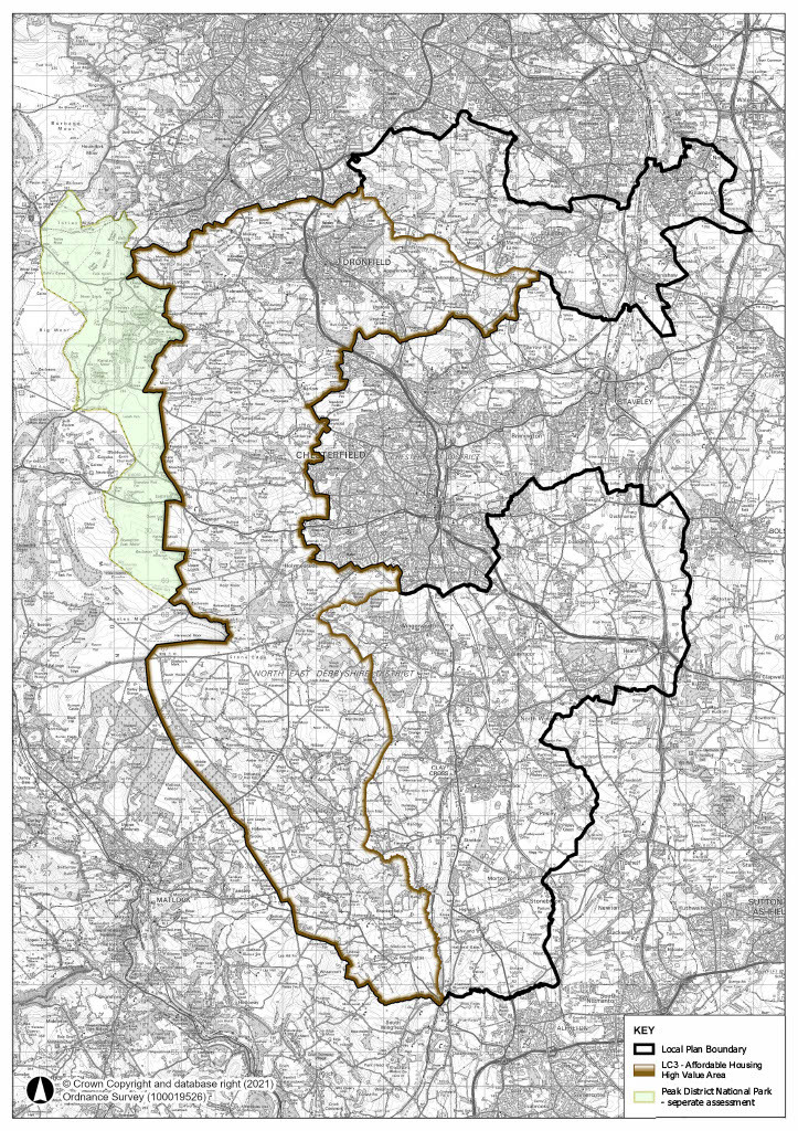
5.5 Exception Sites for Affordable Housing Comment
Exception sites where planning permission may be granted for local needs housing on sites where residential development would not normally be allowed, are an established tool to provide affordable housing. The sites can help to maintain the viability and sustainability of rural communities. However, the availability of public funding for affordable housing has been reduced significantly in recent years. This has led to viability issues for registered providers. In order to bring about the delivery of affordable housing, in some limited circumstances it may be appropriate to allow a small element of market housing in order to cross-subsidise the provision of affordable housing where this meets an identified local housing need. This will contribute to addressing the high level of affordable housing need identified in the 2024 Housing Needs Assessment.
Housing on rural exception sites must meet a genuine identified local need. Local need for this purpose is considered to be the Parish’s need as a minimum. Where up to date housing need data is available on a settlement level, this may also be used. This need must be confirmed by the Council’s most recent Housing Needs Assessment, or an up to date[14] survey carried out by the developer, prior to the submission of a planning application. A local survey may also include (parts of) settlements in neighbouring authorities, where appropriate.
Housing provided on exception sites must remain available for affordable local need in perpetuity. Planning Conditions and/or Section 106 agreements will be required to ensure this. As well as meeting local needs, exception housing should also reflect demand for particular sizes, types and tenure of houses.[15]
Whilst policy LC4: Exception Sites for Affordable Housing seeks to provide 100% affordable exception sites, it also allows for a subsidiary element of market housing on sites outside the Green Belt unless they are identified as grey belt and in circumstances where it can be satisfactorily proven that this would facilitate the delivery of an identified local affordable housing need through a registered provider. Proposals for an element of market housing must be supported by a viability assessment which will be reviewed by the District Valuer to ensure that the proportion of market housing provided is no greater than that required to deliver the agreed amount of affordable housing without the need for public subsidy. The market units must at all times be subsidiary to the affordable housing element and therefore shall be less than 50% of the total number of dwellings on the development scheme.
Policy LC4: Exception Sites for Affordable Housing Comment
- Development proposals for affordable housing in areas outside of the Green Belt, other than sites identified as grey belt*, which would otherwise be contrary to Policy SS11 will be permitted where:
- They would provide affordable housing which would meet a proven local need which is supported by an up-to-date housing needs survey; and
- They are of a size, type, tenure, occupancy and cost suitable to meet identified local need; and
- They have a close association with the built-up part of an existing settlement; and are in keeping with the form, size and character of the settlement, and the local landscape setting; and
- It can be demonstrated that the properties will be allocated to those who are in local housing need, and will remain affordable in perpetuity**.
- Development proposals for affordable housing in areas outside of the Green Belt, other than sites identified as grey belt, may include a subsidiary element of market housing of less than 50% of the total number of dwellings on the development scheme, where it can be demonstrated that:
- The market housing element is limited in proportion to that which is essential to enable the delivery of a viable affordable housing scheme to meet local need, as demonstrated through a viability assessment; and
- The proposals are of a size, type, tenure, occupancy and cost suitable to meet identified local need and (where applicable) be designed to ensure the integration of affordable and market housing such that they differ only in terms of tenure, i.e. not design, type or size.
- Development proposals for affordable housing on land within the Green Belt, that is not identified as grey belt, will only be permitted where it:
- meets requirements a – d of part 1 of this policy; and
- can be demonstrated that there are no suitable alternative development locations outside of the Green Belt that would meet the identified need.
* As shown in the 2026 Green Belt Review.
** This applies to all types of affordable housing, unless specifically exempt by the National Planning Policy Framework.
5.6 Specialist Housing Comment
The District has a slightly older age structure and higher levels of disability compared with the national average. The District’s older person population is also projected to increase notably in the future. An ageing population means that the number of people with disabilities is likely to increase substantially too. In particular, it is expected to see a large increase in the number of people aged 65+ with dementia and/ or mobility problems.
Given this ageing population and higher levels of disability and health problems amongst older people, an increased need for specialist housing options for older and disabled people is expected. Evidence points to the need for a range of forms of specialist housing including for up to 2,200 housing with support units, 720 units of housing with care, and around 850 residential/nursing bedspaces to 2044.
The Council will seek to ensure that the housing needs of older people and people with disabilities are met across all tenures, and that these groups are not restricted in their choice of housing. In addition to allocating sites for specialist accommodation, residential developments of 100 dwellings or more will be required to provide at least 5% of homes designed to meet the needs of older people or people with disabilities.
The Council recognises that specialist housing providers are not always able to operate viably where only a small number of units are provided, particularly where on-site care services are required. Consequently, on larger residential developments the specialist housing provision may comprise age-restricted housing, retirement living or sheltered housing where only a limited number of units are delivered. Provision involving higher levels of care, such as extra care housing, care homes or nursing homes, will generally be expected only on developments capable of delivering a sufficient number of units to support the long-term operation of the care model. The level of support and care provided should increase proportionate to the scale of specialist housing delivered.
The Council would also, as an exception, allow for specialist housing in countryside locations. Proposals for specialist housing which would not meet any of the categories set out in Policy SS11 would be allowed if they meet the criteria in Policy LC5(3).
To address the significant increase in older people with dementia, the Council will require the consideration of dementia-friendly design measures within the specialist housing schemes. The Alzheimer’s Society’s Guide to Dementia Friendly Housing provides guidance on recommended features.
The NPPF is clear that Council’s should consider the accommodation need of children in need of social services care. There has been an increase in children in care in Derbyshire, bringing the county in line with the national average. The Council therefore supports proposals for high-quality accommodation designed to meet the needs of looked after children, young people and care leavers.
Policy LC5: Specialist Housing Comment
- Proposals for well-designed specialist housing for older or disabled people will be supported across all tenures, in appropriate locations, close to services and facilities.
- In residential developments of 100 dwellings or more, at least 5% of homes must be designed and marketed as housing for older or disabled people, unless specific site conditions make this impractical or unviable. This provision can include age-restricted housing, retirement living, sheltered housing, extra care housing, housing with care, or residential care homes and nursing homes. These should be provided in addition to the requirements of Policy LC6. It is expected that the scale of support and care provided through the specialist housing element increases proportionately with the size of the development.
- All development proposals for specialist housing for older people should incorporate dementia-friendly design measures, such as the use of colour, lighting, and signage, to make homes safer and easier to navigate for people living with dementia.
- Specialist housing for children and young people in care is supported where it
- provides a high-quality and inclusive living environment;
- is located within a sustainable location with convenient access to services, education, and public transport;
- promotes independence, wellbeing and community integration;
- meets an identified need; and
- would not result in unacceptable impacts on residential amenity or the character of the area.
- Development proposals for specialist housing in the countryside will be permitted where:
- provision for support or care is included; and
- the proposed specialist housing scheme has a close association with the built-up part of an existing settlement; and
- the proposal is modest in scale, in keeping with the form and character of the settlement and local landscape setting.
5.7 Accessible and Adaptable homes Comment
The Council’s 2024 Housing Needs Assessment identifies a clear need to increase the supply of accessible and adaptable dwellings and wheelchair user dwellings, alongside specialist housing, to meet the needs of the District’s increasing older and disabled population. Many older people, or people with disabilities, wish to be cared for in their own homes. This is increasingly made possible, particularly with the development of assistive technology such as telecare, use of appropriate aids or adaptations to the dwellings and new models of housing related care and/or support services.
Additionally, the Housing Needs estimates a need for 592 wheelchair user dwellings between 2022 and 2044, equating to 27 dwellings per annum.
In response to this need, and in accordance with the recommendations of the Housing Needs Assessment, the Council requires all new dwellings to be designed to be accessible and capable of adaptation to meet the changing needs of occupants over time. In addition, 5% of market dwellings and 10% of affordable dwellings must be designed to meet the needs of wheelchair users, either through adaptation or as fully wheelchair-accessible dwellings from first occupation.
The adaptation of existing homes can also play an important role in enabling people to remain living independently in their community. The Council will therefore be sympathetic to households needing to extend or adapt their existing homes in order to care for older relatives, where any related impacts are acceptable.
Policy LC6: Accessible and Adaptable Homes Comment
- All new dwellings must be designed and built to meet the accessible and adaptable dwelling standard to meet part M4(2) of the Building Regulations 2010 (as amended), or any successor standard.
- Residential developments of 10 or more dwellings must provide at least 5% of market homes and at least 10% of affordable homes to the wheelchair adaptable standards to meet part M4(3)(A) of the Building Regulations 2010 (as amended), or any successor standard. Where the local authority has nomination rights, these 10% of affordable homes must instead be built to wheelchair accessible standards to meet part M4(3)(B) of the Building Regulations 2010(as amended), or any successor standard.
- Where the application of these requirements results in a fractional dwelling, the figure shall be rounded up to the nearest whole dwelling.
5.8 Self and Custom Build Homes Comment
The Council is keen to encourage self and custom build development within the District. The Self-Build and Custom Housebuilding Act 2015 (as amended) defines self-build and custom housebuilding as the building or completion by individuals, associations of individuals or persons working for them. These individuals or groups of individuals should be directly involved in the design process of their house, rather than decisions being made for them.
The Council’s Self and Custom Build Register together with broader demand evidence from secondary sources, shows an approximate need figure of 18 plots per annum, to accommodate those households looking for serviced plots of land in the district on which to build their own homes.
Polic LC7: Self and Custom Build Homes Comment
- Proposals for self and custom build dwellings on individual plots will be supported where they accord with the policies of the development plan, and where the dwelling is initially occupied by the applicant or persons actively involved in the design and layout of the proposed dwelling.
- Where planning permission is sought for a development comprising multiple self-build or custom-build plots, and the detailed design of individual dwellings will be determined by future self or custom builders, proposals must be accompanied by an ‘approved framework’ such as a plot passport or design code.
- The approved framework shall, as a minimum, identify all of the following:
- the location and boundaries of each plot;
- the plot size and indicative developable footprint;
- building lines and separation distances; and
- maximum building heights and scale parameters;
- Any additional site-specific requirements, such as design, landscaping, materials, access and parking may need to be provided where the local context finds this necessary to secure a high-quality development.
- Subsequent detailed applications for individual self-build or custom-build dwellings within such developments are expected to accord with the approved framework. Any variations must be justified and shown to achieve an equal or improved outcome.
- Self and Custom build proposals are expected to accord with all policies of the development plan, including the provision of affordable housing for proposals of 10 or more dwellings. These are to be provided as affordable self-build or custom-build plots.
- Residential developments of 100 dwellings or more must provide serviced self-build and custom-build plots equivalent to at least 5% of the total number of dwellings. Serviced plots must include all of the following:
- have suitable access to a public highway;
- be provided with water, electricity, foul drainage and digital connectivity available at the plot boundary;
- provide sufficient space to accommodate a dwelling and associated development without causing unacceptable impacts on neighbouring existing or future properties and amenities; and
- be subject to an approved plot passport, design code or equivalent framework.
- Where serviced plots remain unsold following a minimum marketing period of 12 months, they may be reverted to deliver general market housing, where it is demonstrated that:
- the plots have been actively marketed at a realistic price; and
- marketing has been directed towards individuals and groups seeking self-build and custom-build opportunities, including those on the Council's self-build and custom housebuilding register; and
- reasonable evidence is provided that there is insufficient demand for the plots.
5.9 Residential Extensions Comment
Residential extensions, alterations and ancillary buildings can provide a practical and acceptable means of adapting homes to meet changing household needs. However, if poorly designed or inappropriately located, extensions can also have a significant impact on the amenity of neighbouring properties and can adversely affect the character and appearance of the surrounding area.
Extensions should complement the existing dwelling, and respect and contribute positively to the character of neighbouring properties and the street scene in general, whilst safeguarding the privacy, outlook and amenity of neighbouring properties. Extensions should generally remain subordinate to the host dwelling.
In line with the overarching objectives of Policy SDC15, all householder development must contribute toward climate change mitigation and resilience. For minor residential developments, this should be achieved in a manner proportionate to the scale of the proposal. Applicants are encouraged to incorporate sustainable design principles from the outset, such as selecting low-carbon or locally sourced materials, ensuring energy-efficient layouts, integrating sustainable drainage (SuDS) to manage surface water, and protecting existing green infrastructure. Detailed guidance on achieving high-quality, sustainable householder design is set out in the Successful Places Design Guide.
Outside Settlement Development Limits, strict controls are required to protect the openness of the Green Belt and the intrinsic character of the countryside, in line with Policies SS11 and SS12. For the purposes of calculating whether a proposal constitutes a "disproportionate addition" in the Green Belt or fails to remain subordinate in the wider countryside, the baseline for assessment is the "original dwelling." In line with the National Planning Policy Framework (NPPF), this is defined as the building as it existed on 1 July 1948, or, if built after this date, as it was originally constructed. This ensures that the cumulative impact of successive, historically permitted extensions is taken into account to prevent the gradual over-development of rural areas.
In some instances, additional accommodation may be required for a dependant person needing care and support to enable them to live alongside a carer. This can be achieved through an extension to the main dwelling, the conversion of a suitable outbuilding or the erection of separate, self-contained ancillary accommodation. All the normal policy provisions will apply to all applications for ancillary accommodation. However, standards of privacy and amenity may be relaxed in relation to the main dwelling, but not in relation to neighbouring properties. In such circumstances the occupation of the accommodation will be tied by condition to the occupation of the main dwelling, to ensure that the accommodation remains ancillary to the principal residence and is not occupied as an independent dwelling.
Policy LC8: Residential Extensions and Ancillary Development Comment
- Proposals for extensions, alterations and ancillary domestic buildings will be permitted provided that they meet all of the following:
- are proportionate to and respect the scale, form, massing, materials and overall design and character of the host dwelling;
- do not materially harm the character, appearance and distinctiveness of the street scene and wider area, including the loss of characteristic boundary features, trees and landscaping;
- protect the privacy and amenity of residents of neighbouring properties;
- provide safe and suitable access, and do not result in an unacceptable impact on highway safety; and
- Development must be of high-quality design incorporating sustainable design principles and energy efficiency measures proportionate to the scale of the proposal, in accordance with Policy SDC15 and the Successful Places Design Guide.
- Outside Settlement Development Limits, development within the Green Belt and/or countryside must meet the following criteria:
- Within the Green Belt, proposals for extensions, alterations, and ancillary buildings will only be permitted where they do not result in disproportionate additions over and above the size of the original dwelling, in accordance with the NPPF and Policy SS12; and
- In the wider countryside, proposals must remain subordinate to the original dwelling in terms of scale and massing, and must conserve the intrinsic character, beauty, and visual amenity of the rural landscape in accordance with Policy SS11.
5.10 Agricultural, Forestry, and other Occupational Dwellings in the Countryside Comment
The countryside plays an important role in supporting agriculture, forestry, equestrian activities and other rural businesses that contribute to the local economy. Much of the district is rural in character. In many instances it will be possible for workers in agricultural and land-based occupations to live in a town or village near to their business location. However, occasionally the nature of the business makes it essential for someone to live on, or in close proximity to the business for operational reasons.
Such dwellings should be commensurate with the needs and requirements of the business and its rural setting, and not the person requiring the accommodation. Unusually large dwellings in relation to the needs of the unit, or expensive construction in relation to the income it can sustain, will not be permitted. The size and scale of the accommodation should be justified by the needs of the business rather than the personal circumstances or preferences of the intended occupier.
Policy LC9: Agricultural, Forestry and Other Occupational Dwellings in the Countryside Comment
- Planning permission for a new dwelling in the countryside to meet the essential functional needs of agriculture, forestry, horticulture, equestrian or other rural businesses will be permitted where all of the following criteria are met:
- robust and independent evidence is submitted with the application demonstrating an essential need for the proposed dwelling which cannot be reasonably met by existing suitable accommodation available in the locality;
- the scale, form and design of the proposed dwelling is appropriate to its functional need and rural setting;
- a financial test is submitted to demonstrate that the enterprise is financially sound and has a clear prospect of remaining viable or in the case of a new or an expansion to the business, there is clear evidence that it has a realistic prospect of becoming financially sustainable;
- the dwelling cannot be reasonably provided by adapting, converting or reusing an existing building on the holding, or through existing accommodation associated with the business;
- the proposed dwelling is located on the holding, and the design will not adversely impact the character and appearance of the countryside;
- the proposed dwelling does not involve replacing a dwelling disposed of as general market housing;
- occupancy is restricted by way of a planning condition or obligation.
- Any proposal for an occupational dwelling shall be subject to a planning obligation to tie the dwelling to the adjacent land and buildings to prevent them being sold separately.
Occupancy restrictions are necessary to ensure that dwellings approved under Policy LC9 remain available to meet the identified needs of agriculture, horticulture, forestry, equestrian activities and other qualifying rural businesses, and continue to serve the purpose for which they were approved rather than becoming unrestricted market housing in the countryside. Where planning permission is granted for a new dwelling, this will be subject to a planning condition, and where appropriate may also be secured through a covenant, restricting occupation to a person solely or mainly working, or last working, in agriculture, horticulture, forestry, equestrian activities or another qualifying rural enterprise, together with their surviving partner and any resident dependants. These restrictions are necessary to ensure that such dwellings continue to meet the needs of qualifying rural occupations and businesses in the locality. employed, in a qualifying rural occupation, together with their dependants.
The Council, however, does recognise that circumstances can change over time, and that an occupational dwelling may no longer be required to meet the need for which it was originally approved. In such cases, any proposal to remove or vary an occupancy restriction will need to demonstrate that there is no longer an essential functional need for the dwelling to serve a rural business.
Policy LC10 below sets out the criteria the Council will apply to any application to remove a restrictive condition to ensure that such dwellings can remain available. An applicant would be expected to appropriately market the dwelling for a reasonable period at a realistic market price for an agricultural tied dwelling to establish whether it could meet the existing functional needs of another local farm or rural business. Robust evidence demonstrating how this requirement has been investigated will need to be included to support any application to vary or remove a restrictive occupancy condition.
Policy LC10: Removal of Agricultural and Other Occupancy Conditions Comment
- Planning permission for the removal or variation of a restrictive occupancy condition relating to agriculture, forestry horticulture, equestrian activities or another qualifying rural business will only be granted where all of the following criteria have been met:
- Evidence has been provided demonstrating that there is no longer an essential functional need for the dwelling on the holding or for the business for which it was originally approved; and
- There is no longer a long-term need for the dwelling to be occupied by a person solely or mainly working, or last working, in agriculture, forestry, horticulture, equestrian activities or another qualifying rural business in the locality; and
- The property has been actively marketed for sale or rent for a continuous period of at least 12 months at an appropriate price that reflects the existence of the occupancy restriction; and
- The marketing exercise demonstrates that it has been undertaken through appropriate channels and that there has been no reasonable interest from eligible purchasers or occupiers.
- Applications must be supported by sufficient evidence to demonstrate compliance with the criteria in Part 1. This should include:
- Details of the holding, business or enterprise and the circumstances that demonstrate the absence of an essential functional need for the dwelling; and
- Evidence supporting the conclusion that there is no longer a long-term local need for the dwelling to serve a qualifying rural occupation or business; and
- Full details of the marketing undertaken, including the duration, asking price, advertising methods and marketing agents used; and
- A record of enquiries received, viewings undertaken and the reasons why no eligible purchaser or occupier was secured.
5.11 Traveller Sites Comment
The Government's Planning Policy for Traveller Sites (2024) (PPTS) seeks to increase the number of traveller sites in appropriate locations with planning permission, addressing under-provision while helping to reduce unauthorised encampments and tensions between settled and traveller communities. In preparing Local Plans, local planning authorities should:
- Set pitch targets for Gypsies and Travellers which address identified accommodation needs, including where appropriate, permanent and transit requirements;
- Identify and update annually a supply of specific deliverable sites sufficient to provide five years' worth of sites against locally set targets;
- Identify a supply of specific developable sites, or broad locations for growth for years 6 to 10 and where possible for years 11 to 15.
The estimated need for Gypsies, Travellers, and Travelling Showpeople in North East Derbyshire is set out in the Gypsy and Traveller Accommodation Assessment (GTAA)[16], a study prepared jointly with neighbouring local authorities. It sets out a requirement for 22 additional pitches[17] using the ethnic definition between 2020-2040; of these, 10 will be needed between 2020-2025, with 4 for each five-year period to 2040. The evidence recommends smaller, family-sized sites to accommodate single or extended family groupings with good access to the strategic road network, services and facilities.
It is also necessary to consider the likely needs for the additional 4 years of the Local Plan period up to 2044. In the absence of specific evidence covering this period, the Council has extrapolated the approach taken by the GTAA and adds on an additional 4 pitches, resulting in a total requirement of 26 pitches between 2020-2044.
5.12 Provision for Travellers Comment
Since 2020 and the adoption of the North East Derbyshire Local Plan (2014–2034), the Council through a combination of allocated sites and additional planning permissions has delivered or secured the delivery of 24 pitches. Of these, 22 pitches are currently occupied and 2 have extant permission, leaving a residual requirement for 2 pitches. Policy LC11 allocates a traveller site which will meet this need.
Table 5.2: Provision for Travellers
|
Source of Supply (2020-2044) |
Pitches |
|---|---|
|
Existing completed provision |
22 |
|
Extant permissions |
2 |
|
Allocations |
2 |
|
Total |
26 |
Policy LC11: Allocation of Traveller Sites Comment
- The following site is allocated for Traveller Pitches as shown on the Policies Map to meet the needs identified in the current Gypsy and Traveller Accommodation Assessment:
|
Site: |
Expected pitch provision: |
|---|---|
|
a. Land off Staveley Lane, Long Duckmanton |
2 |
Proposals for the site must include appropriate and proportional screening along the site boundaries to minimise impact on the landscape.
The Council recognises that accommodation needs may evolve over the plan period in response to changing household formation rates, and as planning permissions are implemented, extended, replaced or expire. Whilst this will continue to be monitored, further flexibility is provided by Policy LC12: Provision for Travellers. This is a positively worded criteria-based policy which will provide a mechanism for considering additional traveller site proposals should further needs arise during the Plan period. This approach provides flexibility and supports the ongoing delivery of traveller accommodation in accordance with national policy.
Traveller sites are often located outside Settlement Development Limits. Where development proposals for traveller sites are located within the countryside, i.e. outside the Settlement Development Limits, Policy LC9 should be read in conjunction with Policy SS11: Development in the Countryside, which recognises that traveller sites may be an appropriate form of development in principle, subject to compliance with the relevant criteria of the Development Plan. Particular regard, however, should be had to national policy relating to isolated development in the countryside and development within the Green Belt.
In considering whether a site is reasonably accessible, the Council will have regard to the availability of local services and facilities, including education, healthcare, employment opportunities, shops and public transport. The suitability of the local highway network, including its ability to safely accommodate caravans and other vehicles associated with traveller communities, will also be taken into account.
Development proposals for traveller sites will be expected to provide a satisfactory living environment for future occupiers and avoid unacceptable impacts on the amenity of neighbouring residents. Relevant considerations may include noise, disturbance, traffic movements, overlooking and visual impact. Proposals will be assessed against Policy SDC15: High-Quality Design and Place Making, and other relevant policies in the Plan.
In assessing whether a development proposal is reasonable in scale, regard will be had to the number of pitches proposed, the overall site area and the relationship of the development to the nearest settled community or surrounding built-up area. Sites should not be of a scale that would dominate the character of the local area.
In addition to Policy LC12, proposals will be assessed against all other relevant policies of the Development Plan, including those relating to sustainable development, design, biodiversity, landscape character, heritage assets, flood risk and transport.
Where issues are identified through the assessment of a proposal, the Council will work proactively with applicants and relevant stakeholders to identify measures that may mitigate adverse impacts. Such measures may include landscaping, access improvements, site layout changes, operational controls or planning obligations where these are necessary, directly related to the development and fairly and reasonably related in scale and kind.
The criteria set out in Policy LC12 below will be applied to all applications for new traveller sites, including those who are in need of culturally appropriate housing but do not meet the planning policy definition of Gypsy and Travellers or Travelling Showpeople (as set out in Annex 1 of Planning Policy for Travellers Sites 2024). This includes applications for temporary stopping places and transit sites, which will still be required to meet all of the criteria, although the level of facilities provided on site will be expected to be appropriate and proportionate to the type of site proposed. Other relevant policies in this Plan will also apply.
Policy LC12: Provision for Traveller Sites Comment
- The Council will seek to ensure the provision of sufficient pitches and plots within the district to meet the identified accommodation needs of Gypsies, Travellers and Travelling Showpeople, as evidenced through the latest Gypsy and Traveller Accommodation Assessment (GTAA) or successor evidence.
- Development proposals for traveller sites, including sites for Gypsies and Travellers and Travelling Showpeople, should where possible be located on previously developed land.
- In all cases developments must:
- Be reasonably accessible to local services and facilities, preferably by walking, cycling or public transport, having regard to the site's location and the availability of sustainable transport options; and
- Be of a scale appropriate to, and would not dominate, the nearest settled community or surrounding built-up area; and
- Provide adequate space for residential accommodation and on-site facilities including parking, vehicle manoeuvring, play areas and both amenity and utility provision; and
- Provide adequate storage and servicing areas to support operational requirements; and
- Not result in unacceptable impacts on the amenity of neighbouring occupiers or future residents of the site; and
- Not cause unacceptable harm to the character of the area, landscape, biodiversity, heritage assets or the wider environment; and
- Provide safe and suitable access arrangements, both vehicular and pedestrian, and not have an unacceptable impact on highway safety and amenity; and
- Be located in areas that are not at unacceptable risk from flooding and can provide satisfactory drainage and utility infrastructure; and
- Address any effects the development might have on local environmental quality (such as noise and air quality, pollution, contamination), and on the health and well-being of any occupants and provide appropriate mitigation measures.
- In addition to meeting the requirements of parts 2 & 3 of this policy, development proposals within the Green Belt will be determined in accordance with national Green Belt policy and relevant policies of this Plan.
[13] 949 dwellings have been completed on small sites between 2014 and 2026.
[14] Not more than 5 years
[15] This relates to all types of affordable housing, unless specifically exempt by the National Planning Policy Framework
[16] Derby, Derbyshire, Peak District National Park Authority and East Staffordshire Gypsy and Traveller Accommodation Assessment July 2023
[17] GTAA pitch definition (para. 9.16, page 90): A pitch size of at least 500sqm (0.05ha) would accommodate the following on-pitch facilities:
- Hard standing for a touring caravan (enabling households to travel)
- Hard standing for a static caravan (including double static trailers)
- 2 car parking spaces
- 1 amenity block
- Hard standing for storage shed and drying
- Garden/amenity area
