Historic Environment Supplementary Planning Document - Consultation Draft (February 2026)
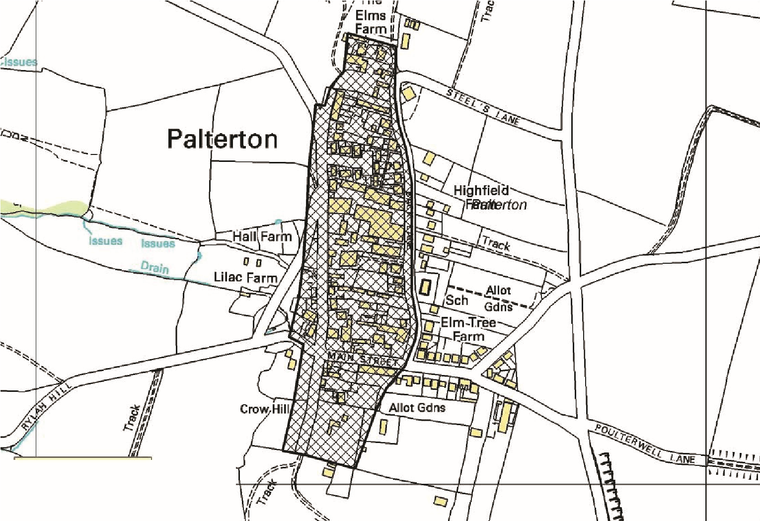
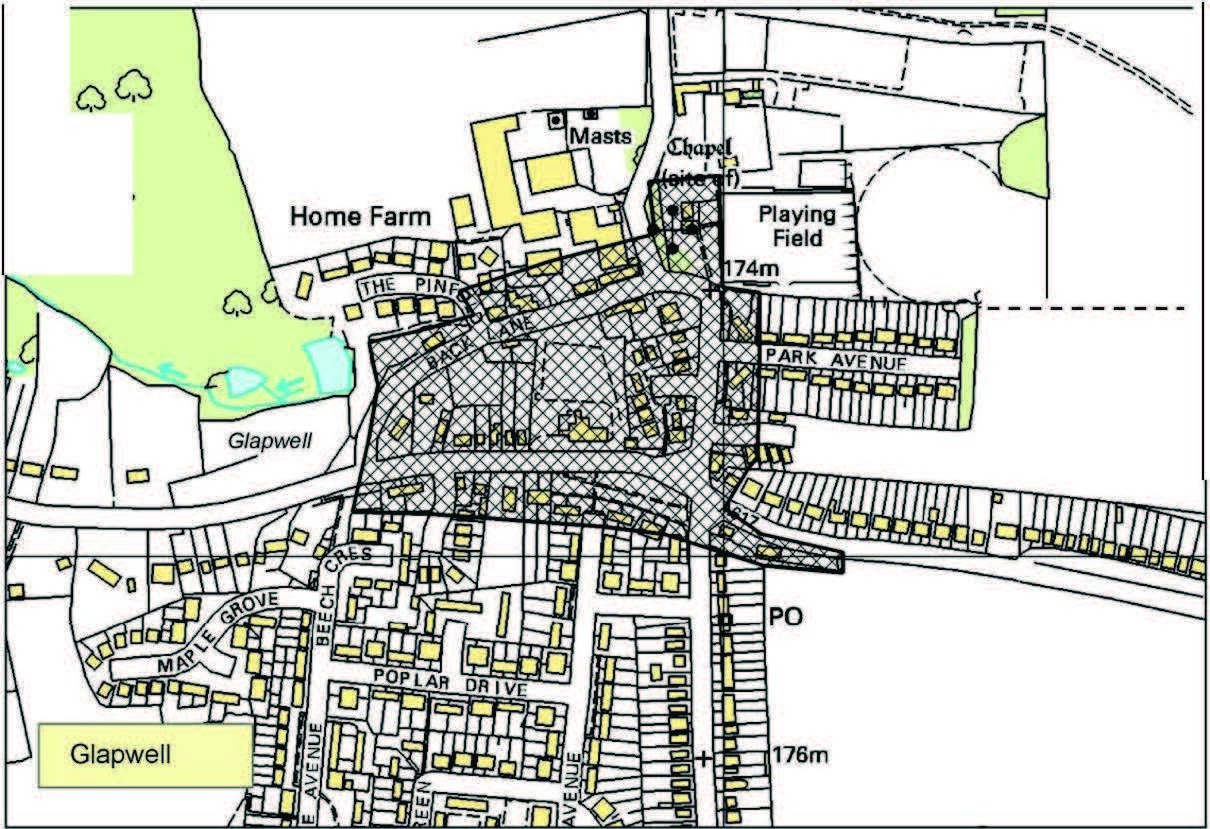
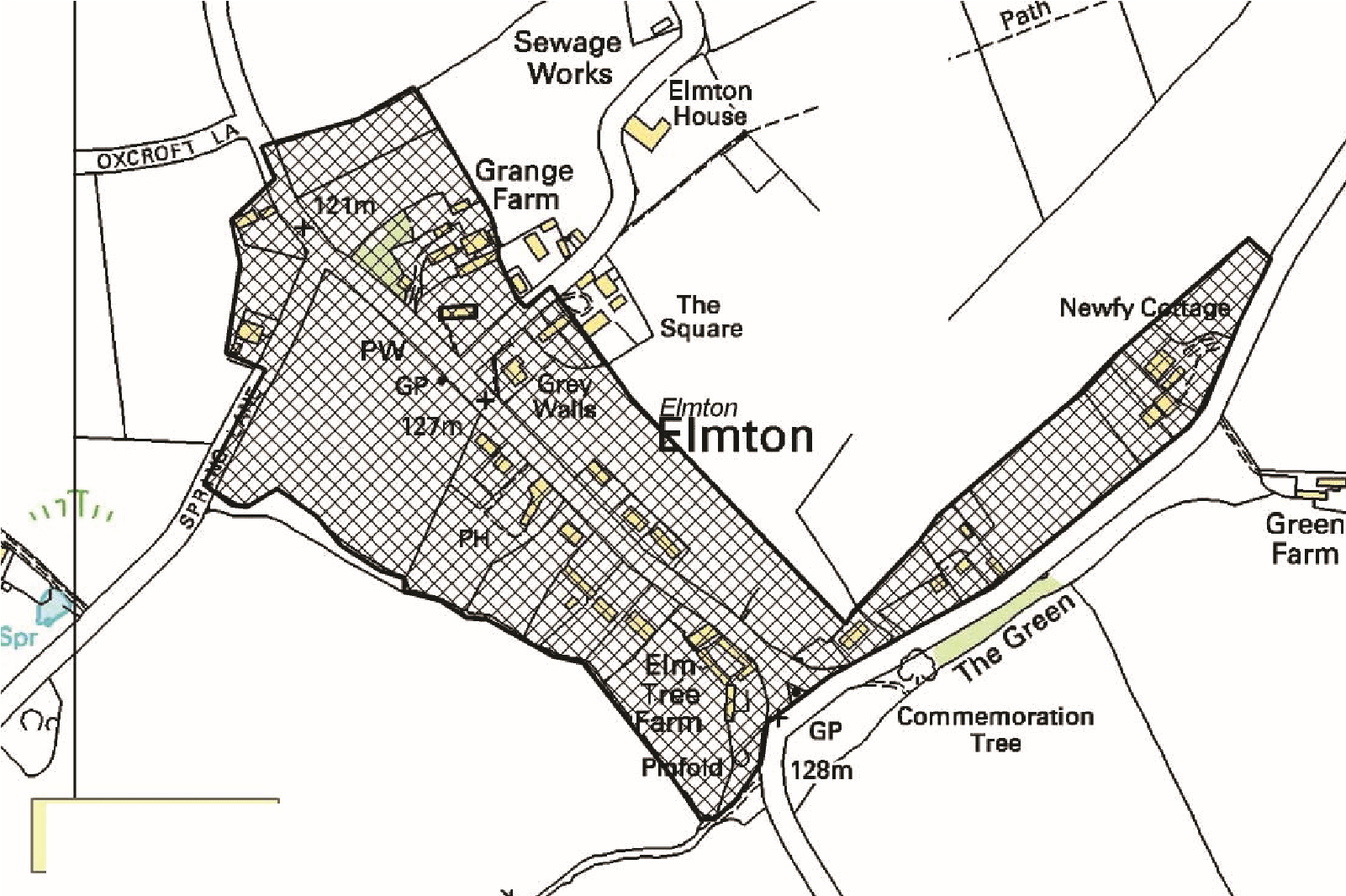
Settlements with potential for medieval archaeology
This copy has been produced specifically for Planning Purposes, no further copies may be made.
Reproduced from the Ordnance Survey map with the permission of the Controller of Her Majesty’s Stationery Office. Crown Copyright 2005.
Unauthorised reproduction infringes Crown Copyright and may lead to prosecution or civil proceedings.
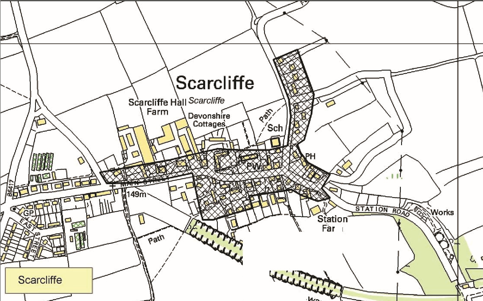
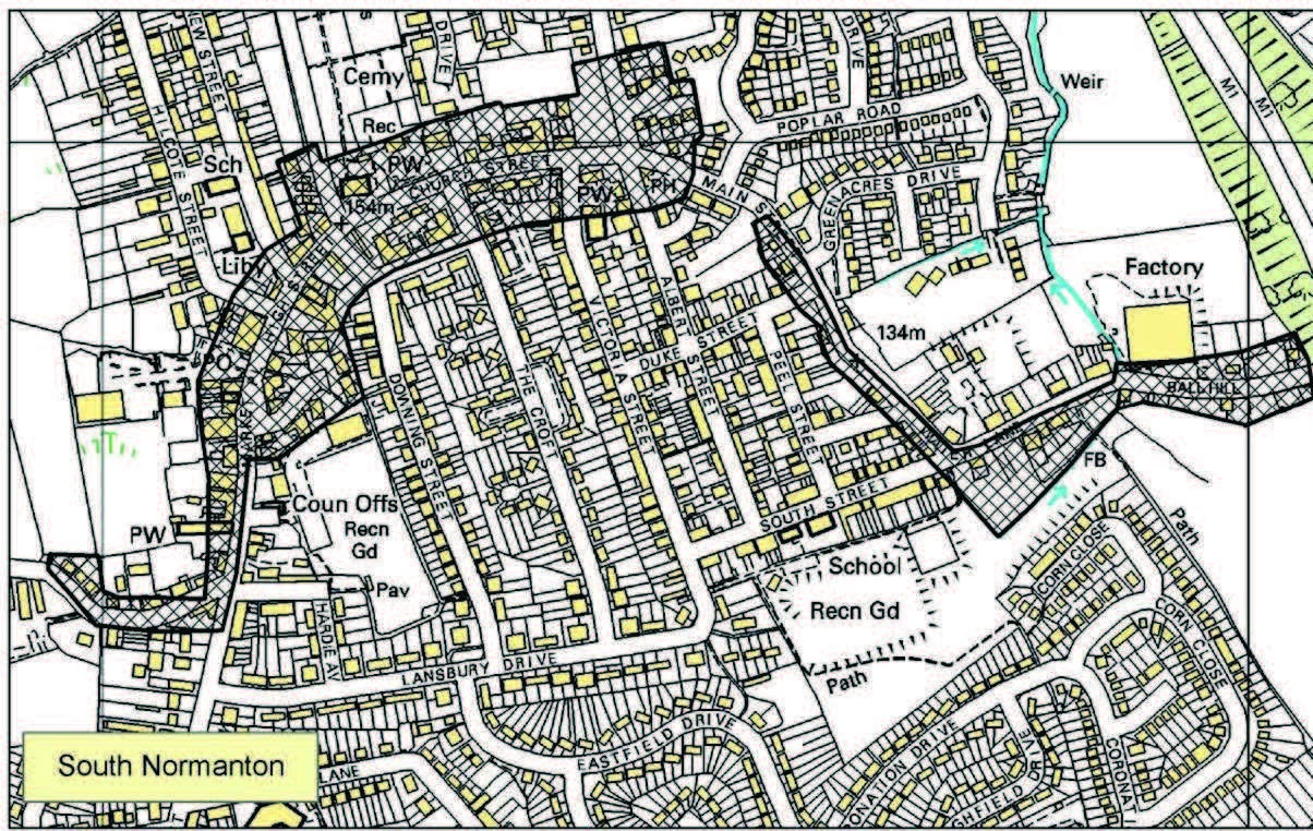
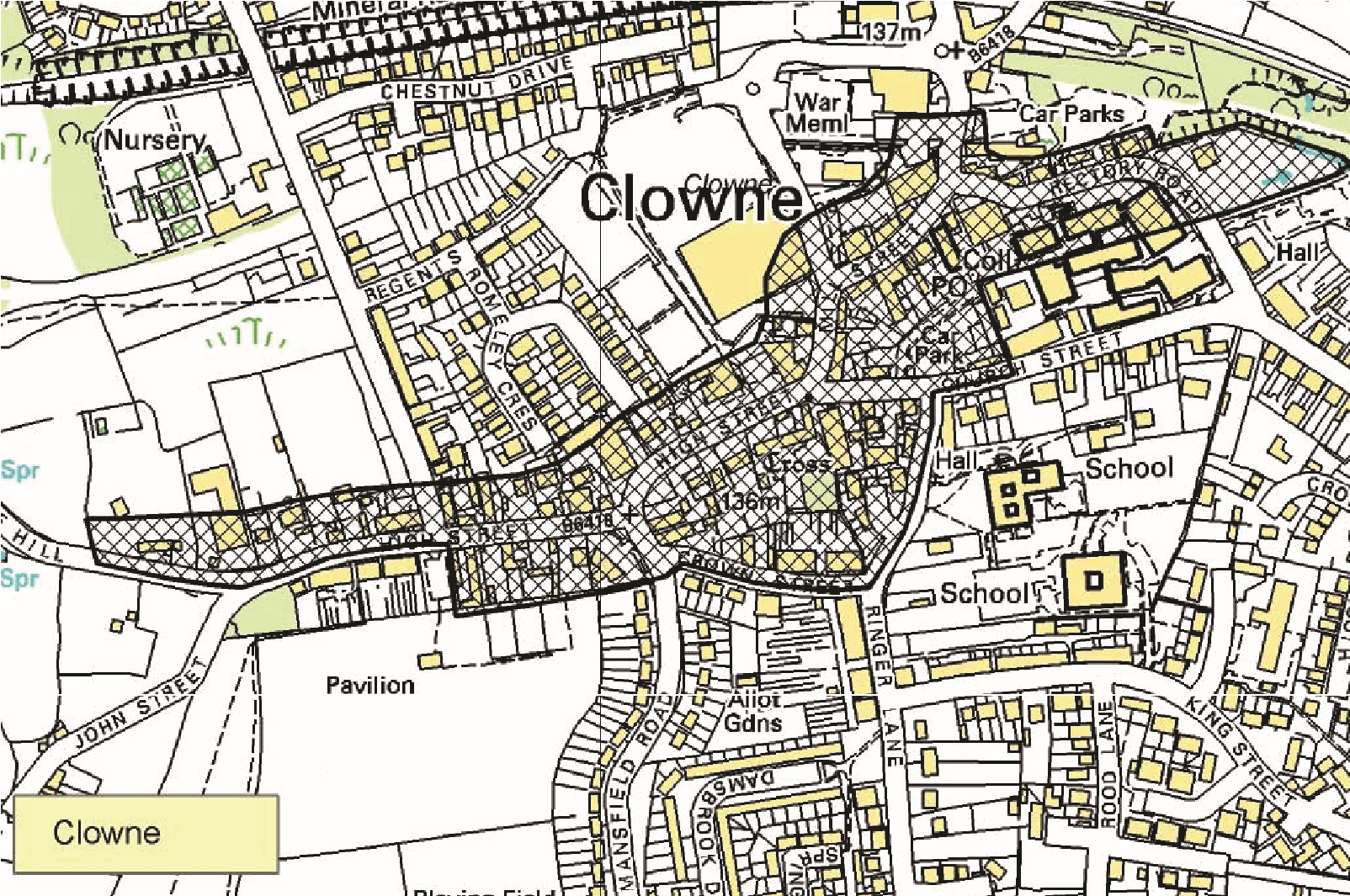
Settlements with potential for medieval archaeology
This copy has been produced specifically for Planning Purposes, no further copies may be made.
Reproduced from the Ordnance Survey map with the perrrission of the Controller of Her Majesty’s Stationery Office. Crown Copyright 2005.
Unauthorised reproduction infringes Crown Copyright and may lead to prosecution or civil proceedings.
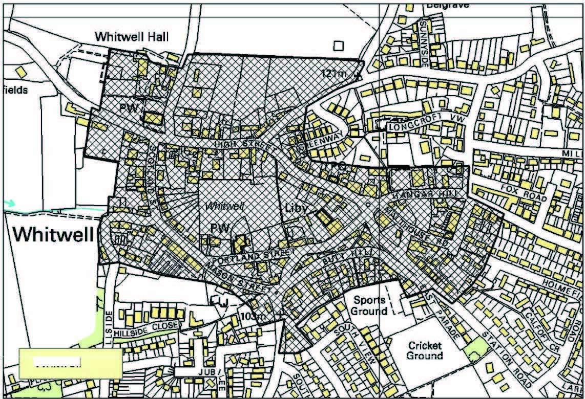
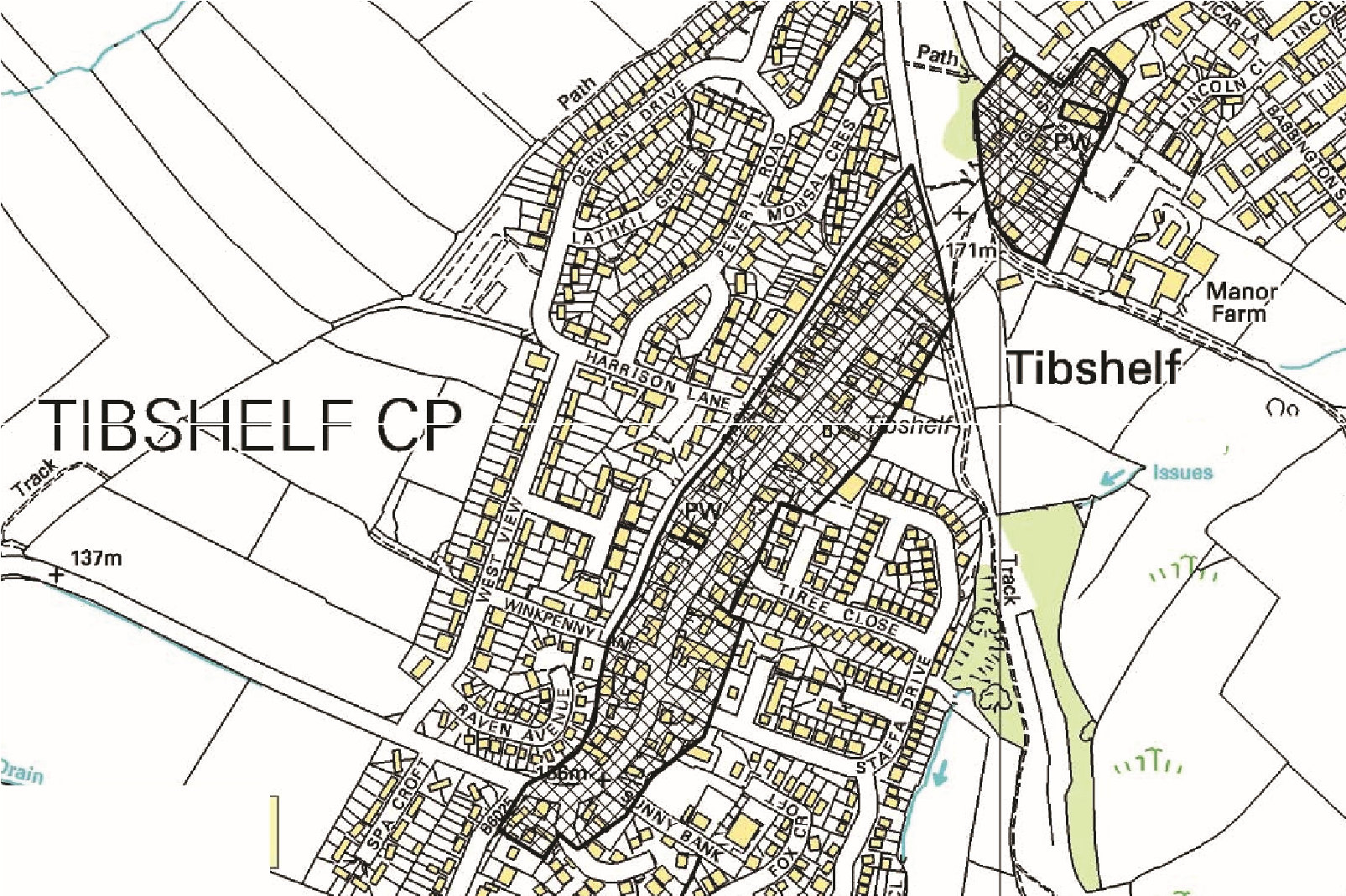
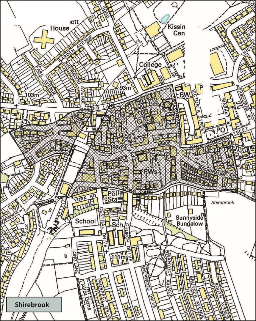
Settlements with potential for medieval archaeology
This copy has been produced specifically for Planning Purposes, no further copies may be made.
Reproduced from the Ordnance Survey map with the perrrission of the Controller of Her Majesty’s Stationery Office. Crown Copyright 2005.
Unauthorised reproduction infringes Crown Copyright and may lead to prosecution or civil proceedings.
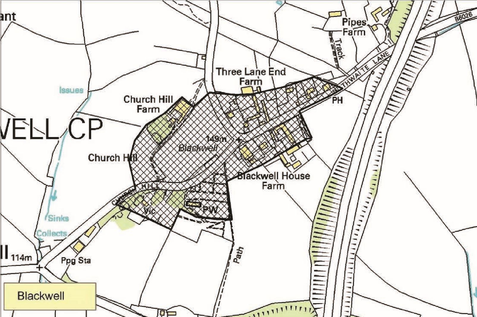
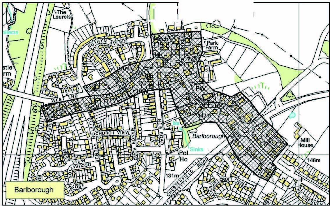
Settlements with potential for medieval archaeology
This copy has been produced specifically for Planning Purposes, no further copies may be made.
Reproduced from the Ordnance Survey map with the perrrission of the Controller of Her Majesty’s Stationery Office. Crown Copyright 2005. Unauthorised reproduction infringes Crown Copyright and may lead to prosecution or civil proceedings.